Ashburton
Airport details
| Country | New Zealand |
| State | Canterbury |
| Region | NZ |
| Municipality | Ashburton District |
| Elevation | 294ft (90m) |
| Timezone | GMT +13 |
| Coordinates | -43.90386, 171.80757 |
| Magnetic var | |
| Type | land |
| Available since | X-Plane v10.40 |
| ICAO code | NZAS |
| IATA code | ASG |
| FAA code | n/a |
Communication
| Ashburton Ashburton ATC | 119.100 |
Nearby Points of Interest:
St John's Church (Anglican) (Formerly Church now Hall)
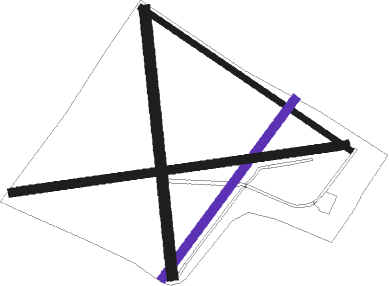
Runway info
Runway 11 / 29  | ||
| length | 1025m (3363ft) | |
| bearing | 120° / 300° | |
| width | 25m (82ft) | |
| surface | grass | |
| Runway 02 / 20 | ||
| length | 896m (2940ft) | |
| bearing | 50° / 230° | |
| width | 35m (115ft) | |
| surface | grass | |
| Runway 16 / 34 | ||
| length | 1081m (3547ft) | |
| bearing | 178° / 358° | |
| width | 45m (148ft) | |
| surface | grass | |
| Runway 06 / 24 | ||
| length | 1370m (4495ft) | |
| bearing | 87° / 267° | |
| width | 35m (115ft) | |
| surface | grass | |
Nearby beacons
| code | identifier | dist | bearing | frequency |
|---|---|---|---|---|
| TU | TIMARU NDB | 34.9 | 235° | 366 |
| CH | CHRISTCHURCH VOR/DME | 38.9 | 61° | 115.30 |
Disclaimer
The information on this website is not for real aviation. Use this data with the X-Plane flight simulator only! Data taken with kind consent from X-Plane 12 source code and data files. Content is subject to change without notice.