Mount Joy/marietta - Donegal Springs Airpark
Airport details
| Country | United States of America |
| State | Pennsylvania |
| Region | K6 |
| Airspace | New York Ctr |
| Municipality | Lancaster County |
| Elevation | 458ft (140m) |
| Timezone | GMT -5 |
| Coordinates | 40.09221, -76.57436 |
| Magnetic var | |
| Type | land |
| Available since | X-Plane v11.50 |
| ICAO code | N71 |
| IATA code | n/a |
| FAA code | n/a |
Communication
| Donegal Springs Airpark UNICOM | 122.800 |
| Donegal Springs Airpark HARRISBURG Approach/Departure | 126.450 |
Nearby Points of Interest:
Byers-Muma House
-Grove Mansion
-Donegal Mills Plantation
-Chickies Historic District
-Ashley and Bailey Silk Mill
-Joseph Bucher House
-Linden House (Marietta, Pennsylvania)
-Kreider Shoe Manufacturing Company
-Locust Grove
-Risser's Mill Covered Bridge
-Wrightsville Historic District
-Columbia–Wrightsville Bridge
-Forry's Mill Covered Bridge
-Columbia Historic District
-Bachman and Forry Tobacco Warehouse
-Wright's Ferry Mansion
-Manor Street Elementary School
-Columbia Wagon Works
-Martin Schultz House
-Michael and Magdealena Bixler Farmstead
-Strickler Family Farmhouse
-Frey-Haverstick Site
-Byrd Leibhart Site
-Dritt Mansion
-Emig Mansion
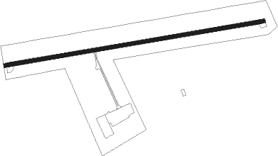
Runway info
| Runway 10 / 28 | ||
| length | 984m (3228ft) | |
| bearing | 86° / 266° | |
| width | 15m (50ft) | |
| surface | asphalt | |
| displ threshold | 94m (308ft) / 0m (0ft) | |
Nearby beacons
| code | identifier | dist | bearing | frequency |
|---|---|---|---|---|
| LRP | LANCASTER VOR/DME | 13.1 | 84° | 117.30 |
| MD | ENOLA (HARRISBURG) NDB | 17.6 | 295° | 204 |
| CX | LATLE (HARRISBURG) NDB | 20.4 | 281° | 219 |
| BZJ | BELLGROVE (INDIANTOWN GAP) NDB | 20.6 | 4° | 328 |
| HAR | HARRISBURG VORTAC | 25.9 | 293° | 112.50 |
| RAV | RAVINE VORTAC | 27.7 | 357° | 114.60 |
| EMI | WESTMINSTER VORTAC | 40.4 | 214° | 117.90 |
| MXE | MODENA VORTAC | 42.8 | 101° | 113.20 |
| SEG | SELINSGROVE VOR/DME | 44.2 | 336° | 110.40 |
| MTN | MARTIN (BALTIMORE) TACAN | 46.3 | 168° | 134.10 |
| FND | ELLICOTT (BALTIMORE) NDB | 49.2 | 194° | 371 |
| ETX | EAST TEXAS VOR/DME | 50.2 | 61° | 110.20 |
| DQO | DUPONT (WILMINGTON) VORTAC | 51 | 113° | 114 |
| IL | HADIN (WILMINGTON) NDB | 53.8 | 118° | 248 |
| FDK | FREDERICK VOR | 55 | 230° | 109 |
| BAL | BALTIMORE VORTAC | 55.4 | 185° | 115.10 |
| MIP | MILTON VORTAC | 56 | 354° | 109.20 |
Disclaimer
The information on this website is not for real aviation. Use this data with the X-Plane flight simulator only! Data taken with kind consent from X-Plane 12 source code and data files. Content is subject to change without notice.