San Luis Potosí - Ponciano Arriaga Intl
Airport details
| Country | Mexico |
| State | San Luis Potosi |
| Region | MM |
| Airspace | Mexico Ctr |
| Municipality | San Luis Potosí |
| Elevation | 6035ft (1839m) |
| Timezone | GMT -6 |
| Coordinates | 22.25541, -100.93449 |
| Magnetic var | |
| Type | land |
| Available since | X-Plane v10.40 |
| ICAO code | MMSP |
| IATA code | SLP |
| FAA code | n/a |
Communication
| Ponciano Arriaga Intl POTOSI Approach/Tower | 118.900 |
Approach frequencies
| ILS-cat-I | RW14 | 111.5 | 18.00mi |
| 3° GS | RW14 | 111.5 | 18.00mi |
Nearby Points of Interest:
Centro
-Pinos
Runway info
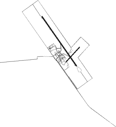
Runway 14 / 32  | ||
| length | 3015m (9892ft) | |
| bearing | 147° / 327° | |
| width | 45m (148ft) | |
| surface | asphalt | |
| blast zone | 58m (190ft) / 58m (190ft) | |
| Runway 04 / 22 | ||
| length | 995m (3264ft) | |
| bearing | 49° / 229° | |
| width | 30m (98ft) | |
| surface | asphalt | |
| blast zone | 32m (105ft) / 40m (131ft) | |
Nearby beacons
| code | identifier | dist | bearing | frequency |
|---|---|---|---|---|
| SLP | POTOSI (SAN LUIS POTOSI) VOR/DME | 0.2 | 77° | 117.20 |
Departure and arrival routes
| Transition altitude | 18500ft |
| Transition level | 19500ft |
| SID end points | distance | outbound heading | |
|---|---|---|---|
| RW14 | |||
| ESPO2A | 25mi | 58° | |
| COYO3A | 25mi | 95° | |
| AVPUS3 | 25mi | 118° | |
| TAMSA3 | 25mi | 155° | |
| MERGO2 | 25mi | 203° | |
| ALOM3A | 25mi | 234° | |
| LIDO3A | 25mi | 249° | |
| RW32 | |||
| LENIM2 | 25mi | 1° | |
| LIRNU2 | 25mi | 13° | |
| ESPO2B | 25mi | 58° | |
| COYO3B | 25mi | 95° | |
| ALOM3B | 25mi | 234° | |
| LIDO3B | 25mi | 249° | |
| ILARI2 | 25mi | 290° | |
| KEPLU2 | 25mi | 324° | |
| DUPMI2 | 25mi | 344° | |
Disclaimer
The information on this website is not for real aviation. Use this data with the X-Plane flight simulator only! Data taken with kind consent from X-Plane 12 source code and data files. Content is subject to change without notice.