Estado De Mexico, Atizapan De Zaragoza - Atizapan De Zaragoza
Airport details
| Country | Mexico |
| State | State of Mexico |
| Region | MM |
| Airspace | Mexico Ctr |
| Municipality | Ciudad Adolfo Lopez Mateos |
| Elevation | 8120ft (2475m) |
| Timezone | GMT -6 |
| Coordinates | 19.57482, -99.28892 |
| Magnetic var | |
| Type | land |
| Available since | X-Plane v10.32 |
| ICAO code | MMJC |
| IATA code | JJC |
| FAA code | n/a |
Communication
| Atizapan De Zaragoza INFO | 118.400 |
Nearby Points of Interest:
Casa de la Covadonga
-Banco de México Building
-Palacio Legislativo de Donceles
-Centro Escolar Revolución
-Xochimilco
-Former Convent of the Nativity
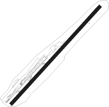
Runway info
| Runway 04 / 22 | ||
| length | 1473m (4833ft) | |
| bearing | 48° / 228° | |
| width | 38m (125ft) | |
| surface | asphalt | |
| displ threshold | 58m (190ft) / 113m (371ft) | |
Nearby beacons
| code | identifier | dist | bearing | frequency |
|---|---|---|---|---|
| SMO | SAN MATEO VOR/DME | 3.6 | 108° | 112.10 |
| MEX | MEXICO VOR/DME | 14.9 | 122° | 115.90 |
| SLM | SANTA LUCIA VOR/DME | 17.7 | 57° | 116.60 |
| TPX | TEPEXPAN NDB | 18.7 | 84° | 359 |
| TLC | TOLUCA VOR/DME | 21.1 | 228° | 114.30 |
| PTJ | PASTEJE VOR/DME | 29.1 | 278° | 114.50 |
| CVJ | CUERNAVACA VOR/DME | 45 | 178° | 113.90 |
| PCA | PACHUCA VOR/DME | 47.8 | 47° | 112.70 |
| APN | APAN VOR/DME | 50.5 | 86° | 114.80 |
| CUA | CUAUTLA VOR/DME | 52.2 | 154° | 116.30 |
| TEQ | TEQUESQUITENGO VOR/DME | 54 | 178° | 113.10 |
| PBC | PUEBLA VOR/DME | 57.6 | 114° | 115.20 |
Disclaimer
The information on this website is not for real aviation. Use this data with the X-Plane flight simulator only! Data taken with kind consent from X-Plane 12 source code and data files. Content is subject to change without notice.