Sabinov - Raznany
Airport details
| Country | Slovakia |
| State | Region of Prešov |
| Region | |
| Airspace | Bratislava Ctr |
| Municipality | Ražňany |
| Elevation | 1048ft (319m) |
| Timezone | GMT +1 |
| Coordinates | 49.08320, 21.09691 |
| Magnetic var | |
| Type | land |
| Available since | X-Plane v10.40 |
| ICAO code | LZRY |
| IATA code | n/a |
| FAA code | n/a |
Communication
| Raznany INFO | 122.600 |
Nearby Points of Interest:
Church in Šarišské Michaľany
-All Saints Church, Medzany
-Church of St. Joseph (Prešov)
-Temple of St Luke, Krivé
-Levoča, Spiš Castle and the associated cultural monuments
-Church of Saint Michael Archangel in Dubne
-Church of Saint John the Evangelist in Muszynka
-Orthodox Epiphany church in Krynica-Zdrój
-Mound in Krynica
-Saint Luke church in Izby
-Sacred Heart church in Krynica-Zdrój
-The building of the Constitutional Court of the Slovak Republic
-General Post office building in Košice
-Apartment block in Štefánikova, Podtatranského and Stará baštová Street
-Košice Town Hall
-Saint Luke church in Zubrzyk
-Saint Nicholas Orthodox chapel in Regietów
-Church of Saint Michael Archangel in Wierchomla Wielka
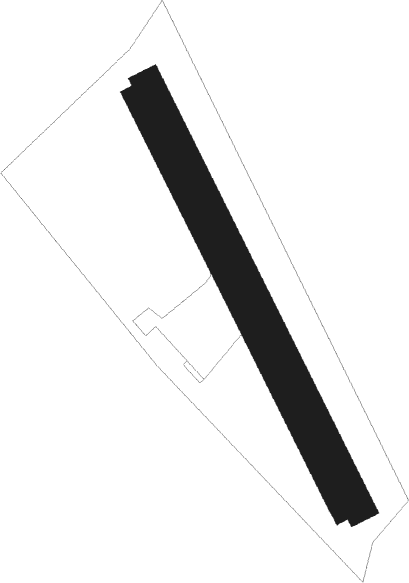
Runway info
Runway 16L / 34R  | ||
| length | 1101m (3612ft) | |
| bearing | 148° / 328° | |
| width | 70m (230ft) | |
| surface | grass | |
| Runway 16R / 34L | ||
| length | 1101m (3612ft) | |
| bearing | 148° / 328° | |
| width | 30m (98ft) | |
| surface | grass | |
Nearby beacons
| code | identifier | dist | bearing | frequency |
|---|---|---|---|---|
| DUB | DME | 17.3 | 114° | 108.65 |
| KTN | DME | 22 | 291° | 114.10 |
| KSC | KOSICE VOR/DME | 24.7 | 159° | 108.20 |
| PE | TATRY EAST NDB | 25.7 | 268° | 438 |
| PPD | TATRY NDB | 29.2 | 269° | 317 |
| PPD | TATRY VOR/DME | 29.4 | 269° | 112.10 |
| KE | KOSICE NDB | 30 | 167° | 425 |
Disclaimer
The information on this website is not for real aviation. Use this data with the X-Plane flight simulator only! Data taken with kind consent from X-Plane 12 source code and data files. Content is subject to change without notice.