Seia
Airport details
| Country | Portugal |
| State | [Other] |
| Region | LP |
| Airspace | Lisbon Ctr |
| Municipality | Seia |
| Elevation | 1456ft (444m) |
| Timezone | GMT +0 |
| Coordinates | 40.45358, -7.68855 |
| Magnetic var | |
| Type | land |
| Available since | X-Plane v10.40 |
| ICAO code | LPSE |
| IATA code | n/a |
| FAA code | n/a |
Communication
Nearby Points of Interest:
Igreja do antigo Convento da Madre de Deus
-Chapel of Santa Marta (Gouveia)
-Casa de Mesquitela
-Palácio dos Condes de Anadia, constituído pelo palácio, jardins, quinta e mata anexa
-Mosteiro do Santo Sepulcro
-Muralhas da Cidade da Covilhã
-Casa da Ínsua
-Antigo Convento do Desagravo do Santíssimo Sacramento
-Anta da Arquinha da Moura
-Arquivo Distrital (Viseu, Portugal)
-Paço da Torre da rua de D. Duarte
-Casa de São Miguel (Viseu)
-Convento de Nossa Senhora da Boa Esperança
-Igreja de Santa Maria (Celorico da Beira)
-Igreja Matriz de São João de Areias
-Castro de Nandufe
-Igreja Matriz de Treixedo
-Mosteiro de Folques, recheio artístico e quinta
-Anta de Pendilhe
-Anta de Pêra do Moço
-Termas Romanas de São Pedro do Sul
-Solar de Beirós
-Palácio de Reriz
-Solar dos Malafaias (Serrazes)
-Ponte da Ribeira de Meimoa
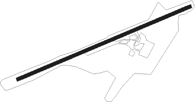
Runway info
| Runway 08 / 26 | ||
| length | 1473m (4833ft) | |
| bearing | 76° / 256° | |
| width | 29m (95ft) | |
| surface | asphalt | |
| displ threshold | 342m (1122ft) / 44m (144ft) | |
Nearby beacons
| code | identifier | dist | bearing | frequency |
|---|---|---|---|---|
| VIS | VISEU VOR/DME | 18.5 | 324° | 113.10 |
| DAR | DME | 37.7 | 312° | 114.90 |
| DMR | DME | 48.5 | 346° | 114.60 |
| OVR | OVAR TACAN | 50.6 | 294° | 110.60 |
| NSA | NISA VOR/DME | 54.3 | 194° | 115.50 |
| FTM | FATIMA VOR/DME | 60 | 226° | 113.50 |
| PRT | PORTO VOR/DME | 66.9 | 309° | 114.10 |
Disclaimer
The information on this website is not for real aviation. Use this data with the X-Plane flight simulator only! Data taken with kind consent from X-Plane 12 source code and data files. Content is subject to change without notice.