Kiryat Shmona
Airport details
| Country | Israel |
| State | North District |
| Region | |
| Airspace | Tel Aviv Ctr |
| Municipality | Kiryat Shmona |
| Elevation | 375ft (114m) |
| Timezone | GMT +2 |
| Coordinates | 33.21120, 35.59179 |
| Magnetic var | |
| Type | land |
| Available since | X-Plane v10.40 |
| ICAO code | LLKS |
| IATA code | KSW |
| FAA code | n/a |
Communication
Nearby Points of Interest:
Hashomer Museum
-Tel Naama
-Dan
-Mishmar HaYarden
-Upper customs house
-Beit Hameiri
-Safed Old City
-Bet Busel
-Tyre
-Beit HaRishonim, Migdal
-Villa Melchett
-Sidon
-Rosh Hanikra train tunnels
-Beit Liberman
-Chouf District
-kinneret farm
-Acre
-Suk al-Abjad
-Al-Hamma Station
-Aammiq Wetland
-Gadara
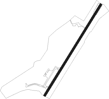
Runway info
| Runway 03 / 21 | ||
| length | 1352m (4436ft) | |
| bearing | 41° / 221° | |
| width | 30m (100ft) | |
| surface | concrete | |
| displ threshold | 63m (207ft) / 144m (472ft) | |
Nearby beacons
| code | identifier | dist | bearing | frequency |
|---|---|---|---|---|
| ROP | ROSH-PINA VOR/DME | 13.7 | 185° | 115.30 |
| BAR | BAYSUR VOR | 33.5 | 356° | 113.90 |
| MEZ | MEZZEH (DAMASCUS) NDB | 35.8 | 67° | 358 |
| KAD | KALDE VOR/DME | 36.1 | 350° | 112.60 |
| RMD | RAMAT DAVID NDB | 38.6 | 217° | 368 |
| BOD | BOD NDB | 41.9 | 351° | 351 |
| ABD | ABYAD (DAMASCUS) NDB | 42.6 | 82° | 264 |
| DAM | DAMASCUS VOR/DME | 44.9 | 80° | 116 |
| NAT | NATANIA VOR/DME | 61.3 | 215° | 112.40 |
Disclaimer
The information on this website is not for real aviation. Use this data with the X-Plane flight simulator only! Data taken with kind consent from X-Plane 12 source code and data files. Content is subject to change without notice.