Velké Porící - Velke Porici
Airport details
| Country | Czechia |
| State | Northeast |
| Region | LK |
| Airspace | Prague Ctr |
| Municipality | Velké Poříčí |
| Elevation | 1325ft (404m) |
| Timezone | GMT +1 |
| Coordinates | 50.46778, 16.20555 |
| Magnetic var | |
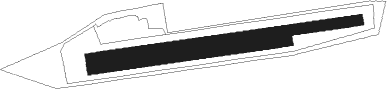
| Type | land |
| Available since | X-Plane v10.40 |
| ICAO code | LKVP |
| IATA code | n/a |
| FAA code | n/a |
Communication
| Velke Porici INFO | 122.200 |
Nearby Points of Interest:
Church of Saint Procopius
-Palace in Jeleniów
-Library in Náchod
-Old town hall in Náchod
-New townhall in Náchod
-Bartoňova vila
-Socha svatého Václava
-Town hall in Police nad Metují
-Sloup se sochou Panny Marie
-Socha svatého Jana Nepomuckého
-Socha svatého Prokopa
-Chapel of the Nativity of the Virgin Mary (Police nad Metují)
-Socha svatého Floriána
-Stations of the Cross in Stárkov
-certovka peklo
-Chapel of Holy Cross
-Chapel of Virgin Mary
-Rectory in Boušín
-Sloup se sousoším Panny Marie
-Kaple Panny Marie Sněžné pod Hvězdou
-Stations of the Cross in Malé Svatoňovice
-Tvrz Velké Svatoňovice
-Nové Město nad Metují

Nearby beacons
| code | identifier | dist | bearing | frequency |
|---|---|---|---|---|
| PK | PARDUBICE NDB | 31.2 | 221° | 432 |
| P | PARDUBICE NDB | 32 | 224° | 888 |
| F | CASLAV NDB | 44.7 | 239° | 715 |
| C | CASLAV NDB | 44.8 | 236° | 715 |
| CF | CASLAV NDB | 45 | 234° | 345 |
| WCL | WROCLAW VOR/DME | 46.2 | 49° | 111.65 |
| TBN | GORNY DME | 59.8 | 49° | 113.60 |
Disclaimer
The information on this website is not for real aviation. Use this data with the X-Plane flight simulator only! Data taken with kind consent from X-Plane 12 source code and data files. Content is subject to change without notice.