Airports for X-Plane offers a convenient way to explore airports and their related communication information for the X-Plane flight simulator. It only uses data from the X-Plane flight simulator itself, and is therefore more reliable than the data that comes from real aviation websites. You can search for airports by using the ICAO code, or browse for airports per country and state. The information displayed is categorized by airport details, runway information, airport communication, approach frequencies (ILS and Glidepath details), details of nearby beacons, SIDs, STARs and approach procedures.

aerodrome airdrome drome international airport capital commuter luggage helicopters asphalt airport apron jet airplane passenger plane warfare airfield traffic pattern airbus air terminal customs stol

Přerov - Prerov

Airport details

CountryCzechia
StateCentral Moravia
RegionLK
AirspacePrague Ctr
MunicipalityPřerov
Elevation675ft (206m)
TimezoneGMT +1
Coordinates49.42593, 17.40483
Magnetic var
Typeland
Available sinceX-Plane v10.40
ICAO codeLKPO
IATA codePRV
FAA coden/a

Communication

Prerov MTower119.750
Prerov MApproach127.775

Approach frequencies

ILS-cat-IRW06110.1518.00mi
3° GSRW06110.1518.00mi
Nearby Points of Interest:
Church of Saint Florian
-
Church of Saint Lawrence
-
Town hall of Tovačov
-
Barokní jezuitský pivovar
-
Battlefield in Tovačov
-
Former synagogue in Kojetín
-
Church of the Purification of Mary
-
Pavlovice u Přerova Castle
-
Windmill in Rymice
-
Kamenný kříž u Stonáče
-
Veselíčko
-
Sloup se sochou svatého Jana Nepomuckého
-
Mincovna (Kroměříž)
-
Biskupský pivovar
-
Velké náměstí 25
-
Velké náměstí 39
-
Church of Saint Maurice (Kroměříž)
-
Maria column in Kroměříž
-
Fountain at Velké náměstí (Kroměříž)
-
Proboštství
-
Jewish town hall in Kroměřiž
-
Měšťanský dům u radnice v Kroměříži
-
Lichtenštejnský seminář
-
Church of Saint Catherine
-
Piaristické gymnázium v Kroměříži

Runway info

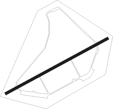
Runway 06 / 24
 length2494m (8182ft)
 bearing74° / 254°
 width60m (197ft)
 surfaceconcrete

Airport layout


Nearby beacons

codeidentifierdistbearingfrequency
KUNKUNOVICE NDB19.1163°416
KNEKUNOVICE NDB22.8173°434
RRADA (OSTRAVA) NDB30.570°534
BBOREK (BRNO) NDB31.3248°429
OTAOSTRAVA VOR/DME31.969°117.45
BNOBRNO VOR/DME32.4249°114.45
NNADA (OSTRAVA) NDB33.369°258
PNYCENTR (PIESTANY) NDB51.7153°297

Disclaimer

The information on this website is not for real aviation. Use this data with the X-Plane flight simulator only! Data taken with kind consent from X-Plane 12 source code and data files. Content is subject to change without notice.