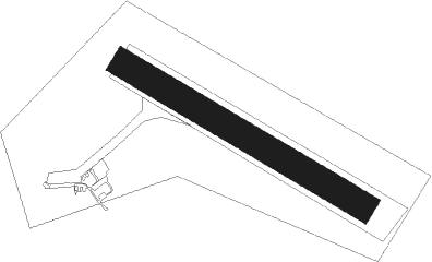
Jičín - Jicin
Airport details
| Country | Czechia |
| State | Northeast |
| Region | LK |
| Airspace | Prague Ctr |
| Municipality | Podhradí |
| Elevation | 859ft (262m) |
| Timezone | GMT +1 |
| Coordinates | 50.43000, 15.33306 |
| Magnetic var | |
| Type | land |
| Available since | X-Plane v10.40 |
| ICAO code | LKJC |
| IATA code | n/a |
| FAA code | n/a |
Communication
| Jicin Jicin Radio | 118.075 |
Nearby Points of Interest:
Vila Dóry Němcové
-Vodárenská věž
-Church of Saint Wenceslaus in Veliš
-Statue of John of Nepomuk in Bukvice
-Calvary in Bukvice
-Chapel of Saint John of Nepomuk
-Chapel of Saint Mary Magdalene
-Valdice Charterhouse
-Sousoší Kalvárie
-Church of Saints Simon and Jude in Chyjice
-Sýpka Střevač
-Maria column in Střevač
-Wayside shrine in Střevač
-kostel svatého Matouše
-Chapel of Our Lady of the Snow
-Statue of Saint Wenceslaus
-Church of Saint Martin
-Socha svatého Floriána
-Chapel of the Holy Sepulchre
-Kalvárie v Sedlišti
-Stations of the Cross to the Tábor hill
-Church of Saint Mary Magdalene
-Boží muka s trojičním motivem
-Rectory in Libáň
-Lovecký zámeček
Nearby beacons
| code | identifier | dist | bearing | frequency |
|---|---|---|---|---|
| NER | NERATOVICE VOR/DME | 27.5 | 265° | 112.25 |
| F | CASLAV NDB | 28.3 | 177° | 715 |
| P | PARDUBICE NDB | 30.1 | 134° | 888 |
| C | CASLAV NDB | 30.4 | 172° | 715 |
| OKX | FRYDLANT VOR/DME | 30.6 | 327° | 114.85 |
| PK | PARDUBICE NDB | 31.1 | 131° | 432 |
| KD | KBELY NDB | 31.4 | 248° | 300 |
| CF | CASLAV NDB | 31.8 | 169° | 345 |
| K | KBELY NDB | 34.4 | 249° | 438 |
| V | MASLOVICE (VODOCHODY) NDB | 38.8 | 258° | 416 |
| VLM | VLASIM VOR/DME | 44.7 | 200° | 114.30 |
| HDO | HERMSDORF VOR/DME | 47.3 | 297° | 108.65 |
| VOZ | VOZICE VOR/DME | 56.7 | 207° | 116.95 |
Disclaimer
The information on this website is not for real aviation. Use this data with the X-Plane flight simulator only! Data taken with kind consent from X-Plane 12 source code and data files. Content is subject to change without notice.