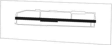
Ralsko - Hradcany
Airport details
| Country | Czechia |
| State | Northeast |
| Region | |
| Airspace | Prague Ctr |
| Municipality | Ralsko |
| Elevation | 912ft (278m) |
| Timezone | GMT +1 |
| Coordinates | 50.61933, 14.72621 |
| Magnetic var | |
| Type | land |
| Available since | X-Plane v10.40 |
| ICAO code | LKHR |
| IATA code | n/a |
| FAA code | n/a |
Communication
| Hradcany INFO | 134.825 |
Nearby beacons
| code | identifier | dist | bearing | frequency |
|---|---|---|---|---|
| NER | NERATOVICE VOR/DME | 15.7 | 203° | 112.25 |
| OKX | FRYDLANT VOR/DME | 20.6 | 47° | 114.85 |
| HDO | HERMSDORF VOR/DME | 22.9 | 311° | 108.65 |
| V | MASLOVICE (VODOCHODY) NDB | 27.4 | 221° | 416 |
| KD | KBELY NDB | 28.2 | 191° | 300 |
| K | KBELY NDB | 30 | 198° | 438 |
| L | LIBOC (PRAGUE) NDB | 34.3 | 221° | 372 |
| OKL | PRAGUE VOR/DME | 36 | 221° | 112.60 |
| F | CASLAV NDB | 46.4 | 136° | 715 |
| DND | DME | 47.8 | 298° | 115.40 |
| FS | DRESDEN NDB | 47.8 | 303° | 374 |
| C | CASLAV NDB | 49.1 | 136° | 715 |
| CF | CASLAV NDB | 50.8 | 135° | 345 |
| VLM | VLASIM VOR/DME | 56.4 | 160° | 114.30 |
| PSK | DME | 56.7 | 220° | 117.60 |
Disclaimer
The information on this website is not for real aviation. Use this data with the X-Plane flight simulator only! Data taken with kind consent from X-Plane 12 source code and data files. Content is subject to change without notice.

