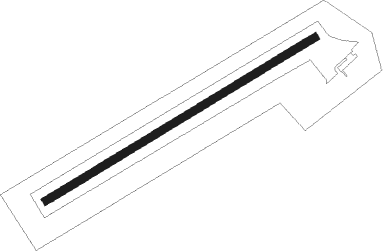
Chrudim
Airport details
| Country | Czechia |
| State | Northeast |
| Region | LK |
| Airspace | Prague Ctr |
| Municipality | Chrudim |
| Elevation | 977ft (298m) |
| Timezone | GMT +1 |
| Coordinates | 49.93639, 15.78056 |
| Magnetic var | |
| Type | land |
| Available since | X-Plane v10.40 |
| ICAO code | LKCR |
| IATA code | n/a |
| FAA code | n/a |
Communication
| Chrudim INFO | 122.800 |
Nearby beacons
| code | identifier | dist | bearing | frequency |
|---|---|---|---|---|
| P | PARDUBICE NDB | 4.5 | 352° | 888 |
| PK | PARDUBICE NDB | 4.6 | 23° | 432 |
| CF | CASLAV NDB | 13.5 | 265° | 345 |
| C | CASLAV NDB | 14.6 | 268° | 715 |
| F | CASLAV NDB | 16.4 | 273° | 715 |
| VLM | VLASIM VOR/DME | 30.9 | 252° | 114.30 |
| VOZ | VOZICE VOR/DME | 42.7 | 246° | 116.95 |
| XU | NAMEST NDB | 45.7 | 159° | 563 |
| X | NAMEST NDB | 47 | 157° | 362 |
| L | NAMEST NDB | 49.3 | 155° | 362 |
| LA | NAMEST NDB | 50.4 | 153° | 514 |
| OKF | DESNA VOR/DME | 58.8 | 194° | 113.15 |
| BNO | BRNO VOR/DME | 59.1 | 131° | 114.45 |
| B | BOREK (BRNO) NDB | 59.9 | 130° | 429 |
| OKX | FRYDLANT VOR/DME | 64.7 | 322° | 114.85 |
Disclaimer
The information on this website is not for real aviation. Use this data with the X-Plane flight simulator only! Data taken with kind consent from X-Plane 12 source code and data files. Content is subject to change without notice.
