Cremona - Cremona Migliaro
Airport details
| Country | Italy |
| State | Lombardy |
| Region | LI |
| Airspace | Milan Ctr |
| Municipality | Cremona |
| Elevation | 161ft (49m) |
| Timezone | GMT +1 |
| Coordinates | 45.16702, 10.00664 |
| Magnetic var | |
| Type | land |
| Available since | X-Plane v10.35 |
| ICAO code | LILR |
| IATA code | n/a |
| FAA code | n/a |
Communication
| Cremona Migliaro Tower | 119.650 |
Nearby Points of Interest:
Archivio di Stato di Cremona
-Province of Cremona
-Cremona
-Santa Maria Maddalena (Cremona)
-Olmeneta
-Paderno Ponchielli
-Acquanegra Cremonese
-Vescovato
-Robecco d'Oglio
-Pieve d'Olmi
-Castelnuovo Bocca d’Adda
-Bordolano
-Annicco
-Pontevico
-Sospiro
-Pieve San Giacomo
-Cicognolo
-Chiesa di Santa Maria Assunta
-Rocca Mandelli
-Gabbioneta-Binanuova
-Pizzighettone
-San Daniele Po
-Verolanuova
-Verolavecchia
-Ca' de' Cervi
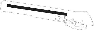
Runway info
| Runway 11 / 29 | ||
| length | 647m (2123ft) | |
| bearing | 99° / 279° | |
| width | 30m (98ft) | |
| surface | asphalt | |
| displ threshold | 46m (151ft) / 0m (0ft) | |
Nearby beacons
| code | identifier | dist | bearing | frequency |
|---|---|---|---|---|
| PIA | PIACENZA TACAN | 19.2 | 229° | 117.40 |
| GHE | GHEDI TACAN | 19.6 | 43° | 110.90 |
| COD | CODOGNO NDB | 20 | 277° | 400 |
| BSA | BRESCIA VOR/DME | 20.8 | 49° | 117.70 |
| ORI | ORIO AL SERIO (BERGAMO) NDB | 29.4 | 341° | 376 |
| TZO | TREZZO NDB | 31.5 | 308° | 345 |
| TZO | TREZZO VOR/DME | 31.6 | 308° | 117.25 |
| LNE | LINATE (MILAN) NDB | 32.1 | 284° | 386 |
| BEG | BERGAMO VOR/DME | 32.6 | 329° | 114.95 |
| LIN | LINATE (MILAN) VOR/DME | 35.5 | 292° | 112.25 |
| VIL | VILLAFRANCA VORTAC | 40.6 | 75° | 115.80 |
| SRN | SARONNO NDB | 50.5 | 296° | 330 |
| GEN | GENOA NDB | 59.4 | 231° | 318 |
| GEN | GENOA VOR/DME | 59.5 | 231° | 112.80 |
Disclaimer
The information on this website is not for real aviation. Use this data with the X-Plane flight simulator only! Data taken with kind consent from X-Plane 12 source code and data files. Content is subject to change without notice.