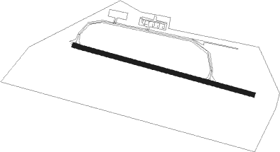
Reggio Emilia
Airport details
| Country | Italy |
| State | Emilia-Romagna |
| Region | LI |
| Airspace | Milan Ctr |
| Municipality | Reggio nell'Emilia |
| Elevation | 148ft (45m) |
| Timezone | GMT +1 |
| Coordinates | 44.69889, 10.66250 |
| Magnetic var | |
| Type | land |
| Available since | X-Plane v10.40 |
| ICAO code | LIDE |
| IATA code | n/a |
| FAA code | n/a |
Communication
| Reggio Emilia AFIS service | 127.150 |
| Reggio Emilia Departure | 127.150 |
Nearby Points of Interest:
Chiesa dei Santi Giacomo e Filippo Apostoli
-Il Mauriziano
-Palazzo del Comune
-San Colombano Abate Church
-Reggia di Rivalta
-Villa Arnò
-Chiesa di San Savino
-Museo Civico Il Correggio
-Chiesa di Santa Maria Annunziata
-Santa Maria Assunta
-Chiesa di Sant'Andrea
-Sant'Antonino Martire, Quattro Castella
-Rocca di Novellara
-Politeama Sociale
-Museo Monumento al Deportato politico e razziale
-Villa Borri
-Museo di anatomia di Modena
-Teatro Anatomico
-Museo del Risorgimento (Modena, Italy)
-Galleria Estense
-Ex Ospedale di Sant'Agostino
-Farmacia storica dell'ex ospedale Sant'Agostino
-Villa Mattei
-Museums of the Modena Cathedral
-Palazzo comunale
Nearby beacons
| code | identifier | dist | bearing | frequency |
|---|---|---|---|---|
| BOA | BOLOGNA VOR/DME | 28.5 | 104° | 117.10 |
| PIA | PIACENZA TACAN | 42.2 | 283° | 117.40 |
| VIL | VILLAFRANCA VORTAC | 43.8 | 19° | 115.80 |
| BSA | BRESCIA VOR/DME | 46.7 | 335° | 117.70 |
| GHE | GHEDI TACAN | 47.6 | 332° | 110.90 |
| SAZ | SARZANA TACAN | 48.6 | 229° | 111.10 |
| PRT | PERETOLA (FLORENCE) VOR/DME | 58.1 | 149° | 112.50 |
| PIN | PISA TACAN | 59.6 | 193° | 108.30 |
| ORI | ORIO AL SERIO (BERGAMO) NDB | 66.5 | 319° | 376 |
| BEG | BERGAMO VOR/DME | 70.8 | 316° | 114.95 |
Disclaimer
The information on this website is not for real aviation. Use this data with the X-Plane flight simulator only! Data taken with kind consent from X-Plane 12 source code and data files. Content is subject to change without notice.