Saint-léger-sur-roanne - Roanne
Airport details
| Country | France |
| State | Auvergne-Rhône-Alpes |
| Region | LF |
| Airspace | Marseille Ctr |
| Municipality | Saint-Léger-sur-Roanne |
| Elevation | 1104ft (336m) |
| Timezone | GMT +1 |
| Coordinates | 46.05272, 3.99961 |
| Magnetic var | |
| Type | land |
| Available since | X-Plane v10.40 |
| ICAO code | LFLO |
| IATA code | RNE |
| FAA code | n/a |
Communication
| Roanne CTAF | 120.900 |
Nearby Points of Interest:
Hôtel de ville de Semur-en-Brionnais
-Prieuré de la Sainte-Trinité de Marcigny-lès-Nonnains
-Maison mitoyenne de la Tour du Moulin
-Maison Cudel de Montcolon
-Hôtel de ville de Marcigny
-Couvent des Ursulines de Marcigny
-chapelle Saint-Benoît de Saint-Maurice-lès-Châteauneuf
-Château de Rochefort
-Porte de ville de Montaiguët-en-Forez
-Église Sainte-Anne du Breuil
-Prieuré d'Anzy-le-Duc
-J.-B. Martin's old weaving factory
-usine du pont de Seychalles
-forges Mondière
-Ferrier outillage
-Abbaye du Moutier (Thiers)
-Maison rue Saturnin-Arloing, Cusset
-Maison, Rue de la Goutte, Cusset
-Maison de Louis XI
-Tour Prisonnière de Cusset
-Groupe scolaire Bellevue (Paray-le-Monial)
-Maison, 50 rue de Strasbourg, Vichy
-Kiosque du parc des Bourins
-Villa Anne-Marie
-Town hall of Vichy
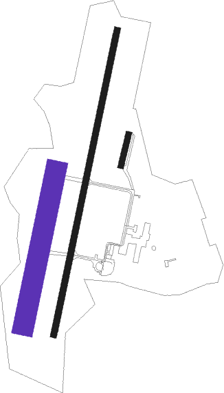
Runway info
Runway 02 / 20  | ||
| length | 1467m (4813ft) | |
| bearing | 23° / 203° | |
| width | 30m (98ft) | |
| surface | asphalt | |
| displ threshold | 300m (984ft) / 0m (0ft) | |
| blast zone | 166m (545ft) / 0m (0ft) | |
| Runway 02L / 20R | ||
| length | 741m (2431ft) | |
| bearing | 23° / 203° | |
| width | 100m (328ft) | |
| surface | grass | |
| Runway 02R / 20L | ||
| length | 150m (492ft) | |
| bearing | 25° / 205° | |
| width | 28m (92ft) | |
| surface | grass | |
Nearby beacons
| code | identifier | dist | bearing | frequency |
|---|---|---|---|---|
| ROA | ROANNE VOR | 0.3 | 357° | 110.25 |
| RNN | ROANNE NDB | 3.9 | 32° | 358 |
| SN | SAINT YAN NDB | 15.3 | 27° | 430 |
| TIS | THIERS VOR/DME | 21.2 | 249° | 117.50 |
| VZ | VICHY NDB | 25.5 | 277° | 403 |
| EB | SAINT ETIENNE NDB | 27.5 | 146° | 379 |
| ASM | CLERMONT-FERRAND/AUVERGNE NDB | 30.5 | 249° | 367 |
| BO | SAINT ETIENNE NDB | 34.3 | 151° | 299 |
| CFA | CLERMONT FERRAND AUVERGNE VOR/DME | 37.3 | 252° | 114.35 |
| MOU | MOULINS VOR/DME | 42.1 | 331° | 116.70 |
| VNE | VIENNE REVENTIN VOR | 47.5 | 119° | 108.20 |
| BR | LYON-BRON NDB | 49.1 | 114° | 388 |
| CC | CHAMPFORGEUIL NDB | 53.2 | 52° | 391 |
| NV | NEVERS NDB | 63.7 | 318° | 394 |
Instrument approach procedures
| runway | airway (heading) | route (dist, bearing) |
|---|---|---|
| RW20 | LO402 (233°) | LO402 4900ft LO406 (7mi, 267°) 3700ft |
| RW20 | SINPO (111°) | SINPO LO404 (27mi, 92°) 5500ft LO406 (7mi, 117°) 3700ft |
| RW20 | SN (207°) | SN 3700ft LO406 (4mi, 216°) 3700ft |
| RNAV | LO406 3700ft LO408 (6mi, 203°) 2900ft LFLO (6mi, 203°) 1118ft (2774mi, 185°) 1700ft SN (2789mi, 5°) 3700ft |
Disclaimer
The information on this website is not for real aviation. Use this data with the X-Plane flight simulator only! Data taken with kind consent from X-Plane 12 source code and data files. Content is subject to change without notice.