Challes-les-eaux - Chambéry Challes Les Eaux
Airport details
| Country | France |
| State | Auvergne-Rhône-Alpes |
| Region | LF |
| Airspace | Marseille Ctr |
| Municipality | Challes-les-Eaux |
| Elevation | 979ft (298m) |
| Timezone | GMT +1 |
| Coordinates | 45.55796, 5.97746 |
| Magnetic var | |
| Type | land |
| Available since | X-Plane v10.40 |
| ICAO code | LFLE |
| IATA code | n/a |
| FAA code | n/a |
Communication
| Chambéry Challes les Eaux CTAF | 118.400 |
Nearby Points of Interest:
Hôtel des Douanes de Chambéry
-Palais de justice de Chambéry
-Hôtel Nicolle de La Place
-Pont Morens
-littoral de Tresserve
-Château de la Roche du Roi (Aix-les-Bains)
-Église Notre-Dame d'Aix-les-Bains
-Aix-les-Bains war memorial
-Pont Royal de Chamousset
-Manoir de la Tour
-Pierre à cupules de La Guettaz
-Château de Voissant
-château de Vaulserre
-Haut-Rhône de la Chautagne aux chutes de Virignin
-Gorges de la Balme
-Châtel de Theys
-Rhône du Pont de Groslée à Murs-et-Gélignieux
-Maison d'Izieu--Mémorial des enfants juifs exterminés
-Séminaire de Belley
-Pierre à cupules de Magnieu (Belley)
-Place de la Cathédrale
-Hôtel Brillat-Savarin
-Abbaye des Ayes (Crolles, France)
-Donjon du Temple
-Les Marais de Saint-Jorioz
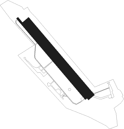
Runway info
Runway 14 / 32  | ||
| length | 991m (3251ft) | |
| bearing | 134° / 314° | |
| width | 20m (66ft) | |
| surface | asphalt | |
| Runway 14L / 32R | ||
| length | 888m (2913ft) | |
| bearing | 134° / 314° | |
| width | 76m (250ft) | |
| surface | grass | |
Nearby beacons
| code | identifier | dist | bearing | frequency |
|---|---|---|---|---|
| CH | CHAMBERY NDB | 4.4 | 290° | 346 |
| AT | ANNECY NDB | 18.3 | 8° | 384 |
| CBY | CHAMBERY VOR/DME | 21.5 | 326° | 115.40 |
| LTP | LA TOUR DU PIN VOR/DME | 23 | 263° | 115.55 |
| EG | GRENOBLE NDB | 27 | 251° | 397 |
| PAS | PASSEIRY VOR/DME | 36.3 | 2° | 116.60 |
| WS | GRENOBLE NDB | 36.6 | 257° | 291 |
| LSE | LYON SAINT EXUPERY VOR/DME | 38.8 | 282° | 114.75 |
| BR | LYON-BRON NDB | 41.5 | 273° | 388 |
| GVA | GENEVA VOR/DME | 42.2 | 13° | 115.75 |
| GLA | GLAND NDB | 52.2 | 17° | 375 |
| SPR | ST PREX VOR/DME | 58.1 | 27° | 113.90 |
Disclaimer
The information on this website is not for real aviation. Use this data with the X-Plane flight simulator only! Data taken with kind consent from X-Plane 12 source code and data files. Content is subject to change without notice.