Angers - Tours Le Louroux
Airport details
| Country | France |
| State | Centre-Val de Loire |
| Region | LF |
| Airspace | Bordeaux Ctr |
| Municipality | Le Louroux |
| Elevation | 0ft (0m) |
| Timezone | GMT +1 |
| Coordinates | 47.15000, 0.71278 |
| Magnetic var | |
| Type | land |
| Available since | X-Plane v10.40 |
| ICAO code | LFJT |
| IATA code | n/a |
| FAA code | n/a |
Communication
| Tours Le Louroux CTAF | 123.500 |
Nearby Points of Interest:
Prieuré du Louroux
-Chapelle et logis troglodytiques de Notre-Dame-de-Lorette
-Halles de Sainte-Maure-de-Touraine
-Maison Putsinus
-hôtel-Dieu de Montbazon
-château des Archevêques
-Abbaye de Cormery
-Lanterne des Morts de Cormery
-Noyers Abbey
-Château de Loches
-maison d'Agnès Sorel
-Hôpital de Loches
-Château d'Azay-sur-Cher
-Ferme de Cours
-Abbaye de Beaumont
-Maladrerie Saint-Lazare (Tours)
-Bretonneau hospital
-Manoir Béranger
-hôtel
-Hôtel Sagey
-Hôtel de Ville de Tours
-église Saint-Clément de Tours
-Hôtel Mame, Tours
-Portail de la trésorerie Saint-Martin
-Tour Foubert
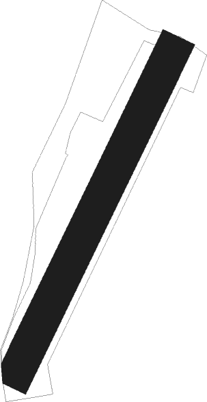
Runway info
| Runway 03 / 21 | ||
| length | 901m (2956ft) | |
| bearing | 41° / 221° | |
| width | 90m (295ft) | |
| surface | grass | |
| displ threshold | 100m (328ft) / 95m (312ft) | |
Nearby beacons
| code | identifier | dist | bearing | frequency |
|---|---|---|---|---|
| TUR | TOURS VAL DE LOIRE TACAN | 16.3 | 4° | 113.80 |
| AMB | AMBOISE NDB | 20.9 | 51° | 341 |
| AMB | AMBOISE VOR/DME | 22 | 52° | 113.70 |
| TUR | TOURS VAL DE LOIRE NDB | 25.1 | 10° | 331 |
| PI | POITIERS NDB | 29.5 | 214° | 363 |
| BLB | BLOIS NDB | 37.2 | 43° | 397 |
| POI | POITIERS BIARDS VOR | 38.1 | 216° | 113.30 |
| AS | ANGERS NDB | 43.5 | 296° | 392 |
| LM | LE MANS NDB | 49.7 | 324° | 326 |
| CHN | CHATEAUDUN TACAN | 60.6 | 36° | 110.20 |
| CAD | CHATEAUDUN VOR/DME | 61 | 37° | 115.95 |
| LP | CHOLET NDB | 63.4 | 269° | 357 |
| ANG | ANGERS VOR | 67.7 | 284° | 113 |
Disclaimer
The information on this website is not for real aviation. Use this data with the X-Plane flight simulator only! Data taken with kind consent from X-Plane 12 source code and data files. Content is subject to change without notice.