Aubigny-sur-nère - Aubigny Sur Nére
Airport details
| Country | France |
| State | Centre-Val de Loire |
| Region | LF |
| Airspace | Paris Ctr |
| Municipality | Aubigny-sur-Nère |
| Elevation | 626ft (191m) |
| Timezone | GMT +1 |
| Coordinates | 47.48056, 2.39417 |
| Magnetic var | |
| Type | land |
| Available since | X-Plane v10.32 |
| ICAO code | LFEH |
| IATA code | n/a |
| FAA code | n/a |
Communication
| Aubigny sur Nére CTAF | 123.500 |
Nearby Points of Interest:
Nançay Radio Telescope
-château de Rivaulde
-Buildings by ceramist Jean Linard
-Château de Maupas
-Mantelot
-Monument à Jean-Félix Bapterosses
-Château de La Ferté-Imbault
-Église Saint-Martin de Marcilly-en-Gault
-Couvent des Augustins de Cosne-Cours-sur-Loire
-Rigole de Courpalet
-Hôtel-Dieu de Bourges
-Couvent des Augustins de Bourges
-Collège des Jésuites de Bourges
-théâtre antique de Neung-sur-Beuvron
-abbaye Saint-Ambroix de Bourges
-Halle au blé de Bourges
-Remparts gallo-romains de Bourges
-Bourges, Lycée Marguerite de Navarre
-hotel de panette - un chateau en ville
-Palais archiépiscopal de Bourges
-Prefecture hotel of Cher
-Portail Saint-Ursin
-Town hall of Jargeau
-Abbaye Saint-Martin de Massay
-Chaire de Saint-Étienne de Jargeau
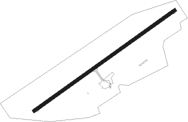
Runway info
| Runway 06 / 24 | ||
| length | 1016m (3333ft) | |
| bearing | 68° / 248° | |
| width | 20m (66ft) | |
| surface | asphalt | |
| displ threshold | 90m (295ft) / 80m (262ft) | |
Nearby beacons
| code | identifier | dist | bearing | frequency |
|---|---|---|---|---|
| AVD | AVORD NDB | 27.1 | 132° | 288 |
| BRG | BOURGES NDB | 28.1 | 194° | 375 |
| ORS | ORLEANS SAINT DENIS DE L'HOTEL NDB | 28.1 | 342° | 322 |
| NEV | NEVERS VOR | 29.3 | 121° | 113.40 |
| BCY | ORLEANS VOR/DME | 39.8 | 308° | 117.35 |
| OAN | ORLEANS-BRICY NDB | 40.1 | 310° | 385 |
| CTX | CHATEAUROUX DEOLS NDB | 40.6 | 227° | 428 |
| PTV | PITHIVIERS VOR | 40.8 | 349° | 116.50 |
| AV | AVORD NDB | 42 | 138° | 306 |
| NV | NEVERS NDB | 45.2 | 123° | 394 |
| MLN | MELUN VILLAROCHE VOR/DME | 60.9 | 23° | 113.60 |
| BRY | BRAY SUR SEINE VOR/DME | 66.3 | 44° | 114.10 |
Disclaimer
The information on this website is not for real aviation. Use this data with the X-Plane flight simulator only! Data taken with kind consent from X-Plane 12 source code and data files. Content is subject to change without notice.