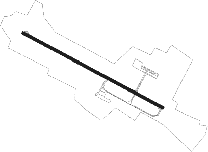
Rochefort/saint-agnant - Rochefort Saint Agnant
Airport details
| Country | France |
| State | Nouvelle-Aquitaine |
| Region | LF |
| Airspace | Bordeaux Ctr |
| Municipality | Saint-Agnant |
| Elevation | 56ft (17m) |
| Timezone | GMT +1 |
| Coordinates | 45.88842, -0.97631 |
| Magnetic var | |
| Type | land |
| Available since | X-Plane v10.40 |
| ICAO code | LFDN |
| IATA code | RCO |
| FAA code | n/a |
Communication
| Rochefort Saint Agnant ROCHEFORT Tower | 119.300 |
| Rochefort Saint Agnant ROCHEFORT INFO | 119.300 |
Nearby Points of Interest:
Hospice of Soubise
-Hôtel de Cheusses
-Arsenal de Rochefort
-Caserne Latouche-Tréville
-Hôpital de la marine
-Magasin aux vivres de Rochefort
-Fortifications de Rochefort
-Halle de Saint-Jean-d'Angle
-Prieuré de Pont-l'Abbé-d'Arnoult
-Prieuré de Sainte-Gemme
-Villa La Jetée
-Fort Enet
-Maison de l'Empereur
-maison Gourgaud
-caserne Montalembert
-maisons Gourgaud
-Pierre Levée de Berthegrille
-Maison Heureuse de Saint-Georges-d'Oléron
-Église Saint-André de Dolus-d'Oléron
-porte Saint-Pierre
-Abbatiale de Saint-Savinien
-Halles de Pisany
-maison des aïeules de Pierre Loti
-batterie Muschel
-Logis de Vallade
Nearby beacons
| code | identifier | dist | bearing | frequency |
|---|---|---|---|---|
| ROC | ROCHEFORT NDB | 0.4 | 270° | 396 |
| RY | ROYAN NDB | 16.9 | 158° | 427 |
| RL | LA ROCHELLE NDB | 18 | 337° | 322 |
| CNA | COGNAC CHATEAUBERNARD VOR/DME | 31 | 109° | 114.65 |
| CGC | COGNAC CHATEAUBERNARD TACAN | 31.1 | 109° | 116.20 |
| OC | COGNAC NDB | 35.2 | 100° | 346 |
| NB | BORDEAUX NDB | 47.9 | 150° | 361 |
| YN | LA ROCHE SUR YON LES AJONCS NDB | 49.7 | 339° | 334 |
| AGO | ANGOULEME NDB | 59.7 | 97° | 404 |
| BD | BORDEAUX NDB | 59.8 | 157° | 393 |
| POI | POITIERS BIARDS VOR | 67.3 | 61° | 113.30 |
Departure and arrival routes
| Transition altitude | 5000ft |
| SID end points | distance | outbound heading | |
|---|---|---|---|
| RW12 | |||
| MARE2S | 14mi | 195° | |
| OLER2S | 40mi | 329° | |
| RW30 | |||
| MARE2N | 14mi | 195° | |
| OLER2N | 40mi | 329° | |
| STAR starting points | distance | inbound heading | |
|---|---|---|---|
| RW30 | |||
| MARE2P | 13.5 | 15° | |
| OLER2P | 39.8 | 149° | |
| CNA2P | 31.0 | 289° | |
Instrument approach procedures
| runway | airway (heading) | route (dist, bearing) |
|---|---|---|
| RW30 | DN302 (292°) | DN302 IDN30 (4mi, 286°) 2500ft |
| RW30 | ROC (90°) | ROC 2500ft DN303 (9mi, 91°) 2500ft DN301 (4mi, 114°) 2500ft IDN30 (5mi, 223°) 2500ft |
| RNAV | IDN30 2500ft FDN30 (4mi, 294°) 2500ft LFDN (8mi, 295°) 107ft DN300 (4mi, 293°) ROC (4mi, 116°) 2500ft |
Holding patterns
| STAR name | hold at | type | turn | heading* | altitude | leg | speed limit |
|---|---|---|---|---|---|---|---|
| MARE2P | ROC | FIX | right | 296 (116)° | 2500ft - 8000ft | 1.0min timed | 220 |
| MARE2R | ROC | FIX | right | 296 (116)° | 2500ft - 8000ft | 1.0min timed | 220 |
| OLER2P | ROC | FIX | right | 296 (116)° | 2500ft - 8000ft | 1.0min timed | 220 |
| OLER2R | ROC | FIX | right | 296 (116)° | 2500ft - 8000ft | 1.0min timed | 220 |
| *) magnetic outbound (inbound) holding course | |||||||
Disclaimer
The information on this website is not for real aviation. Use this data with the X-Plane flight simulator only! Data taken with kind consent from X-Plane 12 source code and data files. Content is subject to change without notice.