Graulhet/montdragon - Montdragon
Airport details
| Country | France |
| State | Occitania |
| Region | LF |
| Airspace | Bordeaux Ctr |
| Municipality | Graulhet |
| Elevation | 581ft (177m) |
| Timezone | GMT +1 |
| Coordinates | 43.76861, 2.00778 |
| Magnetic var | |
| Type | land |
| Available since | X-Plane v10.40 |
| ICAO code | LFCQ |
| IATA code | n/a |
| FAA code | n/a |
Communication
Nearby Points of Interest:
Église Notre-Dame-de-l'Assomption de Cadalen
-Tour de Palmata
-Maison Yversen
-Prison de Gaillac
-Maison, 13 rue de la Courtade, rue d'Anguille in Gaillac
-Tour des Rondes de Lavaur
-Hôtel de Rochegude
-Hôtel du Bosc
-Municipal Theatre of Albi
-Maison au 1 rue Sainte Cécile à Albi
-Hôtel de ville (Albi)
-Maison Enjalbert
-Maison des Viguiers, Albi
-Tour du Boutge
-Maison, 1 rue des Foissants, Albi
-Vermicellerie
-Montauban-Puylaurens Academy
-Domaine de la Fédial
-Château du Gô
-Castella de Saint-Sulpice
-Tour des Cordeliers de Castres
-Hôtel de Nayrac
-Maison, 31 rue de l'Hôtel-de-Ville
-Hôtel Leroy
-Hôtel Poncet
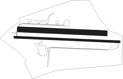
Runway info
Runway 10L / 28R  | ||
| length | 781m (2562ft) | |
| bearing | 95° / 275° | |
| width | 49m (162ft) | |
| surface | grass | |
| Runway 10R / 28L | ||
| length | 963m (3159ft) | |
| bearing | 95° / 275° | |
| width | 20m (66ft) | |
| surface | asphalt | |
| displ threshold | 140m (459ft) / 200m (656ft) | |
Nearby beacons
| code | identifier | dist | bearing | frequency |
|---|---|---|---|---|
| AB | ALBI NDB | 8.9 | 22° | 323 |
| CVU | CASTRES-MAZAMET NDB | 11.9 | 124° | 356 |
| GAI | GAILLAC VOR | 13.6 | 315° | 115.80 |
| TOE | TOULOUSE NDB | 22.3 | 229° | 415 |
| TLB | TOULOUSE NDB | 26.7 | 287° | 368 |
| TS | TOULOUSE NDB | 27.5 | 243° | 423 |
| TOU | TOULOUSE BLAGNAC VOR/DME | 30.7 | 263° | 117.70 |
| CS | CARCASSONNE SALVAZA NDB | 33.9 | 160° | 345 |
| TLF | FRANCAZAL NDB | 36 | 258° | 332 |
| MUT | MURET NDB | 39.8 | 251° | 350 |
| ROM | RODEZ NDB | 42.5 | 47° | 302 |
| RZ | RODEZ NDB | 43.9 | 33° | 387 |
| PMR | PAMIERS NDB | 44.3 | 211° | 384 |
| CL | CAHORS NDB | 44.9 | 316° | 348 |
| TW | TOULOUSE NDB | 45 | 256° | 406 |
| FC | FIGEAC LIVERNON NDB | 55 | 346° | 395 |
Disclaimer
The information on this website is not for real aviation. Use this data with the X-Plane flight simulator only! Data taken with kind consent from X-Plane 12 source code and data files. Content is subject to change without notice.