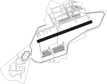
Perigueux - Dax Seyresse
Airport details
| Country | France |
| State | Nouvelle-Aquitaine |
| Region | LF |
| Airspace | Bordeaux Ctr |
| Municipality | Oeyreluy |
| Elevation | 105ft (32m) |
| Timezone | GMT +1 |
| Coordinates | 43.68672, -1.07369 |
| Magnetic var | |
| Type | land |
| Available since | X-Plane v10.40 |
| ICAO code | LFBY |
| IATA code | XDA |
| FAA code | n/a |
Communication
| Dax Seyresse Frequency Ground | 121.775 |
| Dax Seyresse Frequency Tower | 118.325 |
| Dax Seyresse Frequecy Approach | 122.050 |
Nearby Points of Interest:
Enceinte gallo-romaine de Dax
-Pont de la Marquèze
-Église de Saint-Laurent-de-Gosse
-Thermes de Salies-de-Béarn
-Chapelle Sainte-Thérèse (Capbreton)
-Temple protestant d'Orthez
-Église Saint-Martin de Succos
-Citadelle de Bayonne
-Église de l'Assomption de Bonloc
-Le Réduit
-forges d'Uza
-Église Sainte-Madeleine de Saint-Palais
-Ancienne église Saint-Paul de Saint-Palais
-Château de Garro
-abbey of Sauvelade
-Chapelle Notre-Dame-d'Arosse
-Séminaire de Larressore
-Château Boulard
-Commanderie de Caubin
-Château de Françon
-Église Saint-Étienne d'Arhansus
-Espelette Castle
-Église d'Espès
-Rotonde de la Vignotte
-Ancienne prison de Mont-de-Marsan
Nearby beacons
| code | identifier | dist | bearing | frequency |
|---|---|---|---|---|
| DX | DAX SEYRESSE NDB | 2 | 77° | 334 |
| BZ | BIARRITZ PAYS BASQUE NDB | 19.3 | 237° | 341 |
| BTZ | BIARRITZ PAYS BASQUE VOR/DME | 23.1 | 243° | 114.15 |
| MDM | MARSAN (MONT-DE-MARSAN) TACAN | 28 | 69° | 108.70 |
| LGH | MARSAN (MONT-DE-MARSAN) VOR/DME | 28.4 | 69° | 111.65 |
| HIG | SAN SEBASTIAN NDB | 36.2 | 247° | 328 |
| SSN | SAN SEBASTIAN VOR/DME | 39.9 | 244° | 117.90 |
| PU | PAU/PYRENEES NDB | 40 | 115° | 364 |
| BRS | BISCARROSSE NDB | 40.8 | 355° | 358 |
| PO | PAU/PYRENEES NDB | 45.4 | 112° | 397 |
| CAA | CAZAUX TACAN | 50.7 | 356° | 110.80 |
| CAA | CAZAUX NDB | 51.9 | 357° | 382 |
| PP | PAMPLONA NDB | 56.7 | 218° | 354 |
| TBO | TARBES VOR/DME | 57.2 | 106° | 113.90 |
| PAM | PAMPLONA NDB | 63.4 | 210° | 422 |
| PPN | PAMPLONA VOR/DME | 63.4 | 213° | 112.30 |
| PAP | PAMPLONA SOUTH VOR/DME | 65.2 | 210° | 113.55 |
| SAU | SAUVETERRE DE GUYENNE VOR | 71.4 | 43° | 116.80 |
| LMT | AUCH NDB | 72.8 | 89° | 420 |
Disclaimer
The information on this website is not for real aviation. Use this data with the X-Plane flight simulator only! Data taken with kind consent from X-Plane 12 source code and data files. Content is subject to change without notice.