Ortonville - Ortonville Muni-martinson
Airport details
| Country | United States of America |
| State | Minnesota |
| Region | K3 |
| Airspace | Minneapolis Ctr |
| Municipality | Ortonville |
| Elevation | 1100ft (335m) |
| Timezone | GMT -6 |
| Coordinates | 45.30566, -96.42442 |
| Magnetic var | |
| Type | land |
| Available since | X-Plane v10.40 |
| ICAO code | KVVV |
| IATA code | n/a |
| FAA code | VVV |
Communication
| Ortonville Muni-Martinson UNICOM | 122.800 |
Nearby Points of Interest:
Big Stone County Courthouse
-Chicago, Milwaukee, St. Paul and Pacific Depot
-First Congregational Church of Milbank
-Grant County Courthouse
-Graceville Historical Marker
-Appleton City Hall
-First State Bank Building
-Gethsemane Episcopal Church
-Lac Qui Parle County Courthouse
-Madison Carnegie Library
-Swedish Lutheran Church of Strandburg
-Alberta Teachers House
-Browns Valley Carnegie Library
-Morris Industrial School for Indians
-Lac qui Parle Mission
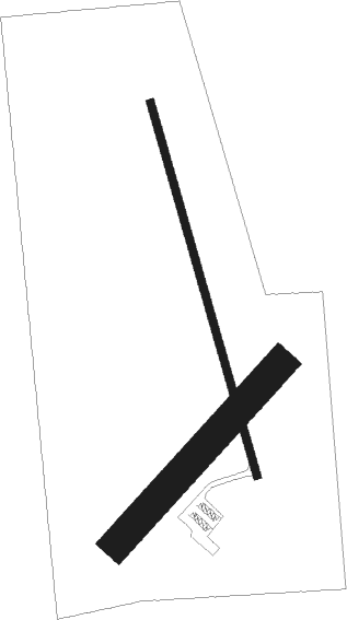
Runway info
Runway 16 / 34  | ||
| length | 1042m (3419ft) | |
| bearing | 164° / 344° | |
| width | 23m (75ft) | |
| surface | asphalt | |
| Runway 04 / 22 | ||
| length | 649m (2129ft) | |
| bearing | 57° / 237° | |
| width | 84m (275ft) | |
| surface | grass | |
Nearby beacons
| code | identifier | dist | bearing | frequency |
|---|---|---|---|---|
| MOX | MORRIS VOR/DME | 24.7 | 60° | 109.60 |
| ATY | WATERTOWN VORTAC | 36.1 | 246° | 116.60 |
| MVE | MONTEVIDEO VOR/DME | 36.1 | 115° | 111.60 |
| GB | GARNO (MARSHALL) NDB | 52.9 | 147° | 253 |
| FF | HAMRE (FERGUS FALLS) NDB | 57 | 22° | 337 |
| MML | MARSHALL VOR/DME | 57.4 | 145° | 111 |
| FFM | FERGUS FALLS VOR/DME | 60.1 | 15° | 110.40 |
| BK | CHRLZ (BROOKINGS) NDB | 61.3 | 209° | 335 |
Instrument approach procedures
| runway | airway (heading) | route (dist, bearing) |
|---|---|---|
| RW34 | ATY (66°) | ATY ILWIR (26mi, 80°) 3600ft KAGRY (8mi, 80°) 3600ft |
| RW34 | DAWSO (325°) | DAWSO KAGRY (8mi, 303°) 3600ft |
| RW34 | KAGRY (344°) | KAGRY 3600ft |
| RNAV | KAGRY 3600ft KUZMO (7mi, 344°) 2600ft KVVV (5mi, 344°) 1136ft (5676mi, 115°) 1501ft NILIE (5677mi, 295°) RIRCO (29mi, 292°) 4500ft RIRCO (turn) |
Disclaimer
The information on this website is not for real aviation. Use this data with the X-Plane flight simulator only! Data taken with kind consent from X-Plane 12 source code and data files. Content is subject to change without notice.