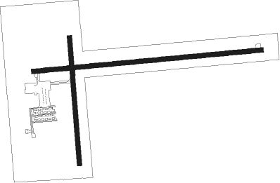
Wauseon - Fulton Co
Airport details
| Country | United States of America |
| State | Ohio |
| Region | K5 |
| Airspace | Cleveland Ctr |
| Municipality | Fulton County |
| Elevation | 776ft (237m) |
| Timezone | GMT -5 |
| Coordinates | 41.60978, -84.12719 |
| Magnetic var | |
| Type | land |
| Available since | X-Plane v10.40 |
| ICAO code | KUSE |
| IATA code | n/a |
| FAA code | USE |
Communication
| Fulton Co CTAF/UNICOM | 123.000 |
| Fulton Co TOLEDO Approach/Departure | 134.350 |
Nearby Points of Interest:
George S. Clement House
-Fulton County Courthouse
-Jones-Read-Touvelle House
-Goll Homestead
-George B. Horton and Amanda Bradish Farmstead
-Henry County Sheriff's Residence and Jail
-Henry County Courthouse
-Dennis-State Streets Historic District
-Adrian Public Library
-Heman R. Goodrich House
-Adrian Engine House No. 1
-Gamaliel Thompson House
-David Carpenter House
-Downtown Adrian Commercial Historic District
-Blissfield Downtown Historic District
-Governor Charles Croswell House
-Hudson Downtown Historic District
-Lenawee County Courthouse
-Lorenzo Palmer and Ruth Wells House
-First Presbyterian Church of Blissfield
-William Treadwell House
-Dodge Site
-Fallen Timbers Battlefield
-Inverness Club
-Fort Defiance

Nearby beacons
| code | identifier | dist | bearing | frequency |
|---|---|---|---|---|
| TO | TOPHR (TOLEDO) NDB | 9.8 | 105° | 219 |
| TOL | TOLEDO TACAN | 14.7 | 93° | 112.50 |
| ADG | ADRIAN NDB | 15.7 | 11° | 278 |
| TCU | TECUMSEH NDB | 27.6 | 30° | 239 |
| LFD | LITCHFIELD VOR/DME | 39.4 | 305° | 111.20 |
| CRL | CARLETON VOR/DME | 39.8 | 57° | 115.70 |
| GW | SHENK (AUBURN) NDB | 40.9 | 250° | 227 |
| JXN | DME | 41.7 | 333° | 115.45 |
| FBC | FLAG CITY VORTAC | 42.7 | 150° | 108.20 |
| DT | REVUP (DETROIT) NDB | 43.6 | 54° | 388 |
| DXO | DETROIT VOR/DME | 49.6 | 52° | 113.40 |
| TII | TIFFIN NDB | 51.4 | 119° | 269 |
| RYS | GROSSE ILE (DETROIT) NDB | 52.6 | 63° | 419 |
| SVM | SALEM VORTAC | 53.5 | 34° | 114.30 |
| DM | SPENC (DETROIT) NDB | 55.2 | 57° | 223 |
Instrument approach procedures
| runway | airway (heading) | route (dist, bearing) |
|---|---|---|
| RW09 | EDGEE (77°) | EDGEE DUCZZ (15mi, 69°) 3000ft |
| RW09 | RANDL (153°) | RANDL DUCZZ (11mi, 224°) 3000ft DUCZZ (turn) 3000ft |
| RNAV | DUCZZ 3000ft XORSE (5mi, 89°) 2400ft KUSE (5mi, 90°) 819ft (5142mi, 116°) 2100ft DUCZZ (5152mi, 296°) 3000ft DUCZZ (turn) | |
| RW27 | CUSMA (247°) | CUSMA YECUK (12mi, 231°) 3000ft |
| RW27 | RANDL (153°) | RANDL YECUK (16mi, 112°) 3000ft YECUK (turn) 3000ft |
| RNAV | YECUK 3000ft WEVUM (5mi, 258°) 2500ft ZOXUK (3mi, 269°) 1340ft KUSE (2mi, 269°) 825ft (5142mi, 116°) 1092ft DUCZZ (5152mi, 296°) 3000ft DUCZZ (turn) |
Disclaimer
The information on this website is not for real aviation. Use this data with the X-Plane flight simulator only! Data taken with kind consent from X-Plane 12 source code and data files. Content is subject to change without notice.