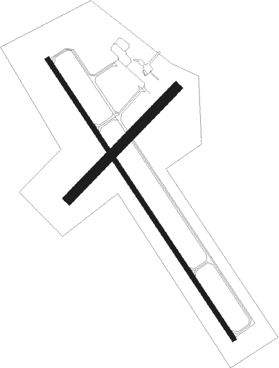
New Ulm - New Ulm Muni
Airport details
| Country | United States of America |
| State | Minnesota |
| Region | K3 |
| Airspace | Minneapolis Ctr |
| Municipality | New Ulm |
| Elevation | 1011ft (308m) |
| Timezone | GMT -6 |
| Coordinates | 44.31857, -94.50150 |
| Magnetic var | |
| Type | land |
| Available since | X-Plane v10.40 |
| ICAO code | KULM |
| IATA code | ULM |
| FAA code | ULM |
Communication
| New Ulm Muni AWOS 3 | 118.325 |
| New Ulm Muni CTAF/UNICOM | 122.800 |
Nearby Points of Interest:
New Ulm Oil Company Service Station
-Boesch, Hummel, and Maltzahn Block
-Flandrau State Park CCC/WPA/Rustic Style Historic Resources
-Nora Free Christian Church
-Fort Ridgely
-Gibbon Village Hall
-Fort Ridgely State Park CCC/Rustic Style Historic Resources
-Minneopa State Park WPA/Rustic Style Historic Resources
-Watonwan County Courthouse
-Grand Opera House
-First Baptist Church
-Union Presbyterian Church
-Lower Sioux Agency
-Eugene Saint Julien Cox House
-First National Bank of Mankato
-Lorin Cray House
-Federal Courthouse and Post Office
-Renesselaer D. Hubbard House
-St. Peter Armory
-Nicollet County Courthouse and Jail
-First Presbyterian Church
-Kern Bridge
-Emily and Stephen Schumacher House
-Blue Earth County Courthouse
-Old Main

Nearby beacons
| code | identifier | dist | bearing | frequency |
|---|---|---|---|---|
| MKT | MANKATO VOR/DME | 26 | 100° | 110.80 |
| RWF | REDWOOD FALLS VOR/DME | 28.3 | 283° | 113.30 |
| FRM | DME | 40.5 | 173° | 110.20 |
| FNX | DME | 41 | 173° | 114.25 |
| FQ | MONTZ (FAIRMONT) NDB | 45.4 | 166° | 420 |
| DWN | DARWIN VORTAC | 46.2 | 4° | 109 |
| BDH | WILLMAR VOR/DME | 54.9 | 322° | 113.70 |
| OT | WONDD (WORTHINGTON) NDB | 59.1 | 234° | 277 |
Instrument approach procedures
| runway | airway (heading) | route (dist, bearing) |
|---|---|---|
| RW15 | BEEGR (225°) | BEEGR KADPE (16mi, 260°) 3000ft KADPE (turn) 3000ft |
| RW15 | OSHOF (121°) | OSHOF KADPE (7mi, 95°) 3000ft |
| RW15 | WIDIS (198°) | WIDIS KADPE (21mi, 224°) 3000ft |
| RNAV | KADPE 3000ft WOTVO (6mi, 142°) 2500ft ZARMO (2mi, 142°) 1760ft KULM (3mi, 141°) 1045ft (5598mi, 115°) 1261ft YEBUY (5593mi, 295°) 3000ft YEBUY (turn) | |
| RW33 | BEEGR (225°) | BEEGR YEBUY (24mi, 193°) 3000ft YEBUY (turn) 3000ft |
| RW33 | OSHOF (121°) | OSHOF YEBUY (28mi, 129°) 3000ft YEBUY (turn) 3000ft |
| RW33 | TUPBU (294°) | TUPBU YEBUY (11mi, 270°) 3000ft |
| RW33 | WAGIK (360°) | WAGIK YEBUY (9mi, 45°) 3000ft |
| RNAV | YEBUY 3000ft CETOT (6mi, 322°) 2500ft ZUDIL (2mi, 322°) 1840ft KULM (3mi, 323°) 1043ft (5598mi, 115°) 1211ft KADPE (5603mi, 295°) 3000ft KADPE (turn) |
Disclaimer
The information on this website is not for real aviation. Use this data with the X-Plane flight simulator only! Data taken with kind consent from X-Plane 12 source code and data files. Content is subject to change without notice.