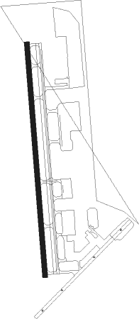
Tupelo - Tupelo Rgnl
Airport details
| Country | United States of America |
| State | Mississippi |
| Region | K7 |
| Airspace | Memphis Ctr |
| Municipality | Tupelo |
| Elevation | 346ft (105m) |
| Timezone | GMT -6 |
| Coordinates | 34.26900, -88.76989 |
| Magnetic var | |
| Type | land |
| Available since | X-Plane v10.40 |
| ICAO code | KTUP |
| IATA code | TUP |
| FAA code | TUP |
Communication
| TUPELO RGNL ASOS | 133.525 |
| TUPELO RGNL CTAF | 118.775 |
| TUPELO RGNL Ground Control | 121.825 |
| TUPELO RGNL Tower | 118.775 |
Approach frequencies
| ILS-cat-I | RW36 | 108.5 | 18.00mi |
| 3° GS | RW36 | 108.5 | 18.00mi |
Nearby beacons
| code | identifier | dist | bearing | frequency |
|---|---|---|---|---|
| OTB | TUPELO VOR/DME | 3 | 211° | 109.80 |
| TU | VERON (TUPELO) NDB | 5.3 | 179° | 420 |
| HAB | DME | 37.8 | 95° | 110.40 |
| CBM | CALEDONIA (COLUMBUS) VORTAC | 41.1 | 152° | 115.20 |
| UV | TUNNG (OXFORD) NDB | 43 | 278° | 426 |
| UU | SEYER (CORINTH) NDB | 45.4 | 12° | 334 |
| HLI | HOLLY SPRINGS VORTAC | 46.8 | 305° | 112.40 |
| IGB | BIGBEE (COLUMBUS) VORTAC | 48.7 | 162° | 116.20 |
Instrument approach procedures
| runway | airway (heading) | route (dist, bearing) |
|---|---|---|
| RW18 | ZUMHA (180°) | ZUMHA 3000ft |
| RNAV | ZUMHA 3000ft BONND (7mi, 180°) 2000ft ZALIM (2mi, 180°) 1200ft KTUP (3mi, 180°) 388ft (5344mi, 111°) 544ft GAGYE (5344mi, 291°) 3000ft GAGYE (turn) | |
| RW36 | GAGYE (360°) | GAGYE 3000ft |
| RNAV | GAGYE 3000ft COMBT (9mi, 360°) 2000ft NATEZ (3mi, 360°) 920ft KTUP (2mi, 360°) 402ft (5344mi, 111°) 546ft ZUMHA (5344mi, 291°) 3000ft ZUMHA (turn) |
Disclaimer
The information on this website is not for real aviation. Use this data with the X-Plane flight simulator only! Data taken with kind consent from X-Plane 12 source code and data files. Content is subject to change without notice.
