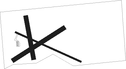
Tracy - Tracy Muni
Airport details
| Country | United States of America |
| State | Minnesota |
| Region | K3 |
| Airspace | Minneapolis Ctr |
| Municipality | Tracy |
| Elevation | 1338ft (408m) |
| Timezone | GMT -6 |
| Coordinates | 44.24910, -95.60720 |
| Magnetic var | |
| Type | land |
| Available since | X-Plane v10.40 |
| ICAO code | KTKC |
| IATA code | n/a |
| FAA code | TKC |
Communication
| Tracy Muni AWOS 3 | 120.000 |
| Tracy Muni CTAF | 122.900 |
Nearby beacons
| code | identifier | dist | bearing | frequency |
|---|---|---|---|---|
| MML | MARSHALL VOR/DME | 15.1 | 312° | 111 |
| GB | GARNO (MARSHALL) NDB | 20 | 310° | 253 |
| RWF | REDWOOD FALLS VOR/DME | 24.3 | 66° | 113.30 |
| OTG | WORTHINGTON VOR/DME | 36.1 | 178° | 110.60 |
| OT | WONDD (WORTHINGTON) NDB | 38.4 | 167° | 277 |
| MVE | MONTEVIDEO VOR/DME | 43.6 | 352° | 111.60 |
| BDH | WILLMAR VOR/DME | 56 | 29° | 113.70 |
Instrument approach procedures
| runway | airway (heading) | route (dist, bearing) |
|---|---|---|
| RW11 | GHENT (134°) | GHENT JADIP (4mi, 144°) 3200ft CURLU (5mi, 217°) 3200ft |
| RW11 | POEMS (63°) | POEMS LEBIC (25mi, 44°) 3500ft CURLU (5mi, 37°) 3200ft |
| RW11 | RWF (246°) | RWF CURLU (32mi, 260°) 3200ft CURLU (turn) 3200ft |
| RNAV | CURLU 3200ft CICAY (6mi, 111°) 3200ft KTKC (6mi, 111°) 1376ft (5646mi, 115°) 1741ft DUPPA (5637mi, 295°) 3000ft DUPPA (turn) | |
| RW29 | DUPPA (292°) | DUPPA 3000ft |
| RW29 | OTG (358°) | OTG AYUBO (27mi, 19°) 3400ft DUPPA (5mi, 37°) 3000ft |
| RW29 | RWF (246°) | RWF BUKAC (16mi, 219°) 3000ft DUPPA (5mi, 217°) 3000ft |
| RNAV | DUPPA 3000ft CIGOD (6mi, 292°) 3000ft KTKC (5mi, 291°) 1371ft (5646mi, 115°) 1740ft CURLU (5656mi, 295°) 3200ft CURLU (turn) |
Disclaimer
The information on this website is not for real aviation. Use this data with the X-Plane flight simulator only! Data taken with kind consent from X-Plane 12 source code and data files. Content is subject to change without notice.

