Starkville - George M Bryan
Airport details
| Country | United States of America |
| State | Mississippi |
| Region | K7 |
| Airspace | Memphis Ctr |
| Municipality | Starkville |
| Elevation | 333ft (101m) |
| Timezone | GMT -6 |
| Coordinates | 33.43311, -88.84861 |
| Magnetic var | |
| Type | land |
| Available since | X-Plane v10.40 |
| ICAO code | KSTF |
| IATA code | n/a |
| FAA code | STF |
Communication
| George M Bryan AWOS-3 | 118.975 |
| George M Bryan CTAF | 122.700 |
| George M Bryan Columbus Approach/Departure | 135.600 |
Approach frequencies
| LOC | RW36 | 109.9 | 18.00mi |
Nearby Points of Interest:
Waverley
-Charles McLaran House
-Harris-Banks House
-Weaver Place
-South Columbus Historic District
-Old Fort House
-Stephen D. Lee House
-Brownrigg-Harris-Kennebrew House
-Cox-Uithoven House
-The Cedars
-Goodwin-Harrison House
-Yates-Flora House
-John Holliday House
-West Commerce Street Historic District
-Reuben Davis House
-United States Courthouse and Post Office
-Aberdeen City Hall
-Bynum Mound and Village Site
-Judge Bates House
-Houston Carnegie Library
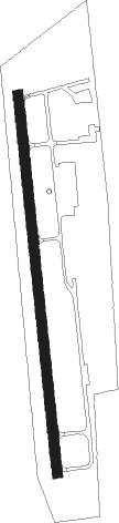
Runway info
| Runway 18 / 36 | ||
| length | 1695m (5561ft) | |
| bearing | 178° / 358° | |
| width | 46m (150ft) | |
| surface | asphalt | |
| displ threshold | 421m (1381ft) / 0m (0ft) | |
Nearby beacons
| code | identifier | dist | bearing | frequency |
|---|---|---|---|---|
| IGB | BIGBEE (COLUMBUS) VORTAC | 17 | 81° | 116.20 |
| CBM | CALEDONIA (COLUMBUS) VORTAC | 24 | 63° | 115.20 |
| TU | VERON (TUPELO) NDB | 45 | 6° | 420 |
| OTB | TUPELO VOR/DME | 47.5 | 4° | 109.80 |
| NMM | MERIDIAN TACAN | 53.5 | 160° | 111.90 |
| HAB | DME | 62.1 | 48° | 110.40 |
| UV | TUNNG (OXFORD) NDB | 69 | 321° | 426 |
Instrument approach procedures
| runway | airway (heading) | route (dist, bearing) |
|---|---|---|
| RW18 | FESBO (178°) | FESBO 3400ft |
| RNAV | FESBO 3400ft ONAZU (6mi, 178°) 2000ft YODLY (3mi, 178°) 1160ft KSTF (3mi, 178°) 364ft (5347mi, 111°) 616ft FEXIS (5347mi, 291°) 3000ft FEXIS (turn) | |
| RW36 | FEXIS (358°) | FEXIS 3000ft |
| RNAV | FEXIS 3000ft SOUER (6mi, 358°) 2000ft UZWIR (3mi, 358°) 1140ft KSTF (3mi, 358°) 361ft (5347mi, 111°) 521ft FESBO (5348mi, 291°) 3400ft FESBO (turn) |
Disclaimer
The information on this website is not for real aviation. Use this data with the X-Plane flight simulator only! Data taken with kind consent from X-Plane 12 source code and data files. Content is subject to change without notice.