Salina - Salina Regional
Airport details
| Country | United States of America |
| State | Kansas |
| Region | K3 |
| Airspace | Kansas City Ctr |
| Municipality | Salina |
| Elevation | 1288ft (393m) |
| Timezone | GMT -6 |
| Coordinates | 38.79662, -97.64075 |
| Magnetic var | |
| Type | land |
| Available since | X-Plane v10.40 |
| ICAO code | KSLN |
| IATA code | SLN |
| FAA code | SLN |
Communication
| Salina Regional ATIS | 120.150 |
| Salina Regional Salina Ground | 121.900 |
| Salina Regional Salina Tower | 119.300 |
Approach frequencies
| ILS-cat-I | RW35 | 108.9 | 18.00mi |
| 3° GS | RW35 | 108.9 | 18.00mi |
Nearby Points of Interest:
Masonic Temple
-Farmers State Bank
-Hans Hanson House
-Rock City, Kansas
-Lebold Mansion
-Atchison, Topeka and Santa Fe Railway 3415
-Fort Harker
-McPherson Opera House
-Canton Township Carnegie Library
-Lincoln County Courthouse
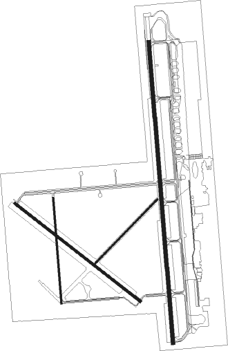
Runway info
Runway 17 / 35  | ||
| length | 3758m (12329ft) | |
| bearing | 180° / 360° | |
| width | 46m (150ft) | |
| surface | asphalt | |
| blast zone | 255m (837ft) / 45m (148ft) | |
| Runway 4 / 22 | ||
| length | 1113m (3652ft) | |
| bearing | 56° / 236° | |
| width | 23m (75ft) | |
| surface | asphalt | |
| blast zone | 11m (36ft) / 25m (82ft) | |
| Runway 12 / 30 | ||
| length | 1983m (6506ft) | |
| bearing | 126° / 306° | |
| width | 30m (100ft) | |
| surface | asphalt | |
| blast zone | 45m (148ft) / 45m (148ft) | |
| Runway 18 / 36 | ||
| length | 1314m (4311ft) | |
| bearing | 180° / 360° | |
| width | 23m (75ft) | |
| surface | asphalt | |
Nearby beacons
| code | identifier | dist | bearing | frequency |
|---|---|---|---|---|
| SL | FLORY (SALINA) NDB | 6.9 | 182° | 344 |
| SLN | SALINA VORTAC | 7.7 | 9° | 117.10 |
| FRI | FORT RILEY (JUNCTION CITY VOR | 37.9 | 77° | 109.40 |
| HRU | HERINGTON NDB | 39.3 | 97° | 407 |
| HU | SALTT (HUTCHINSON) NDB | 42.5 | 203° | 404 |
| CA | HARVS (NEWTON) NDB | 42.7 | 151° | 395 |
| HUT | HUTCHINSON VOR/DME | 49.9 | 200° | 116.80 |
| MHK | MANHATTAN VOR/DME | 49.9 | 70° | 110.20 |
Instrument approach procedures
| runway | airway (heading) | route (dist, bearing) |
|---|---|---|
| RW12 | CUBKA (144°) | CUBKA 3400ft HEMTU (5mi, 229°) 3400ft |
| RW12 | CUNUX (103°) | CUNUX 3400ft HEMTU (5mi, 49°) 3400ft |
| RW12 | HEMTU (121°) | HEMTU 3400ft |
| RNAV | HEMTU 3400ft HIXZA (6mi, 125°) 3000ft ZOMUT (3mi, 125°) 2040ft KSLN (3mi, 110°) 1303ft IRACE (12mi, 130°) 3400ft IRACE (turn) | |
| RW17 | CISUV (207°) | CISUV 3400ft KOWDU (5mi, 270°) 3400ft |
| RW17 | JIKOK (151°) | JIKOK 3400ft KOWDU (5mi, 90°) 3400ft |
| RW17 | KOWDU (178°) | KOWDU 3400ft |
| RNAV | KOWDU 3400ft ODGOC (6mi, 180°) 2900ft KSLN (6mi, 177°) 1301ft (5762mi, 112°) 1496ft DIGBE (5764mi, 292°) 3400ft DIGBE (turn) | |
| RW30 | HISIX (335°) | HISIX 3400ft IRACE (5mi, 49°) 3400ft |
| RW30 | IRACE (310°) | IRACE 3400ft |
| RW30 | WASNI (289°) | WASNI 3400ft IRACE (5mi, 229°) 3400ft |
| RNAV | IRACE 3400ft EMYIC (6mi, 306°) 3000ft CUTEP (3mi, 306°) 2040ft KSLN (3mi, 327°) 1317ft HEMTU (12mi, 301°) 3400ft HEMTU (turn) | |
| RW35 | DIGBE (1°) | DIGBE 3400ft |
| RW35 | HEVTI (28°) | HEVTI 3400ft DIGBE (5mi, 90°) 3400ft |
| RW35 | OYATI (334°) | OYATI 3400ft DIGBE (5mi, 270°) 3400ft |
| RNAV | DIGBE 3400ft GUYCE (6mi, 360°) 2900ft KSLN (6mi, 3°) 1319ft (5762mi, 112°) 1521ft KOWDU (5762mi, 292°) 3400ft KOWDU (turn) |
Disclaimer
The information on this website is not for real aviation. Use this data with the X-Plane flight simulator only! Data taken with kind consent from X-Plane 12 source code and data files. Content is subject to change without notice.