South St Paul - South St Paul Muni
Airport details
| Country | United States of America |
| State | Minnesota |
| Region | K3 |
| Airspace | Minneapolis Ctr |
| Municipality | South St. Paul |
| Elevation | 818ft (249m) |
| Timezone | GMT -6 |
| Coordinates | 44.85714, -93.03286 |
| Magnetic var | |
| Type | land |
| Available since | X-Plane v10.40 |
| ICAO code | KSGS |
| IATA code | n/a |
| FAA code | SGS |
Communication
| South St Paul Muni AWOS 3 | 119.425 |
| South St Paul Muni Clearance DEL | 118.200 |
| South St Paul Muni CTAF/UNICOM | 122.700 |
| South St Paul Muni MINNEAPOLIS Approach/Departure | 121.200 |
Approach frequencies
| LOC | RW34 | 108.35 | 18.00mi |
Nearby Points of Interest:
Serbian Home
-Stockyards Exchange
-St. Stefan's Romanian Orthodox Church
-Reuben Freeman House
-George W. Wentworth House
-Rau/Strong House
-Riverview Branch Library
-Saint Matthew's School
-Colorado Street Bridge
-Charles Spangenberg Farmstead
-Riverside Hangar
-Holman Field Administration Building
-Mendota Road Bridge
-Anthony Yoerg, Sr. House
-Holz Family Farmstead
-Cordenio Severance House
-Harriet Island Pavilion
-Minnesota Boat Club Boathouse on Raspberry Island
-Wabasha Street Bridge
-Giesen–Hauser House
-William Dahl House
-John M. Armstrong House
-Saint Paul City Hall and Ramsey County Courthouse
-Lauer Flats
-Irvine Park Historic District
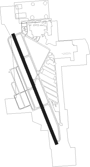
Runway info
| Runway 16 / 34 | ||
| length | 1220m (4003ft) | |
| bearing | 156° / 336° | |
| width | 30m (100ft) | |
| surface | asphalt | |
Nearby beacons
| code | identifier | dist | bearing | frequency |
|---|---|---|---|---|
| MSP | MINNEAPOLIS VOR/DME | 8.9 | 281° | 115.30 |
| FGT | FARMINGTON VORTAC | 15 | 213° | 115.70 |
| FCM | FLYING CLOUD (MINNEAPOLIS VOR/DME | 17.5 | 266° | 117.70 |
| GEP | GOPHER (MINNEAPOLIS) VORTAC | 22.5 | 310° | 117.30 |
| RG | REGUE (RED WING) NDB | 22.6 | 124° | 274 |
| FOW | HALFWAY (MORRISTOWN) VOR/DME | 41.7 | 207° | 111.20 |
| OW | TONNA (OWATONNA) NDB | 47.3 | 189° | 379 |
| PNM | PRINCETON NDB | 48.9 | 321° | 368 |
| ROS | RUSH CITY NDB | 50.4 | 5° | 282 |
| MKT | MANKATO VOR/DME | 53.6 | 234° | 110.80 |
| ST | HUSSK (ST CLOUD) NDB | 54.4 | 304° | 342 |
| RZN | DME | 64.1 | 34° | 109.40 |
| BXR | BIG DOCTOR (SIREN) NDB | 64.3 | 35° | 203 |
Departure and arrival routes
| Transition altitude | 18000ft |
| Transition level | 18000ft |
| STAR starting points | distance | inbound heading | |
|---|---|---|---|
| ALL | |||
| AGUDE5 | 31.7 | 247° | |
Instrument approach procedures
| runway | airway (heading) | route (dist, bearing) |
|---|---|---|
| RW34 | FGT (33°) | FGT ZIQPO (10mi, 79°) 3000ft ZIQPO (turn) 3000ft |
| RW34 | PRESS (293°) | PRESS ZIQPO (12mi, 263°) 3000ft |
| RNAV | ZIQPO 3000ft AVBAF (6mi, 336°) 2400ft KSGS (5mi, 336°) 855ft (5534mi, 116°) 1400ft ZIQPO (5531mi, 296°) 3000ft ZIQPO (turn) |
Holding patterns
| STAR name | hold at | type | turn | heading* | altitude | leg | speed limit |
|---|---|---|---|---|---|---|---|
| AGUDE5 | BEERI | VHF | right | 127 (307)° | 1.0min timed | ICAO rules | |
| *) magnetic outbound (inbound) holding course | |||||||
Disclaimer
The information on this website is not for real aviation. Use this data with the X-Plane flight simulator only! Data taken with kind consent from X-Plane 12 source code and data files. Content is subject to change without notice.