Swainsboro - East Georgia Regl
Airport details
| Country | United States of America |
| State | Georgia |
| Region | K7 |
| Airspace | Atlanta Ctr |
| Municipality | Swainsboro |
| Elevation | 327ft (100m) |
| Timezone | GMT -5 |
| Coordinates | 32.60914, -82.36994 |
| Magnetic var | |
| Type | land |
| Available since | X-Plane v10.40 |
| ICAO code | KSBO |
| IATA code | SBO |
| FAA code | SBO |
Communication
| East Georgia Regl AWOS 3 | 133.375 |
| East Georgia Regl CTAF/UNICOM | 122.975 |
Approach frequencies
| ILS-cat-I | RW14 | 109.35 | 18.00mi |
| 3° GS | RW14 | 109.35 | 18.00mi |
Nearby Points of Interest:
James Coleman House
-Swainsboro Light and Water Plant
-Albert Neal Durden House
-Josiah Davis House
-John Rountree Log House
-Twin City Historic District
-Davis-Proctor House
-First Methodist Episcopal Church
-Treutlen County Courthouse
-Johnson County Courthouse
-Candler County Jail
-Candler County Courthouse
-Metter Downtown Historic District
-South Metter Residential Historic District
-Upper Lott's Creek Primitive Baptist Church and Cemetery
-Birdsville Plantation
-Jefferson County Courthouse
-Louisville Commercial Historic District
-Vidalia Commercial Historic District
-Old Market
-Citizens Bank of Vidalia
-Leader–Rosansky House
-Peterson-Wilbanks House
-Crawford W. Brazell House
-Robert and Missouri Garbutt House
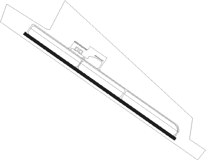
Runway info
| Runway 14 / 32 | ||
| length | 1837m (6027ft) | |
| bearing | 125° / 305° | |
| width | 30m (100ft) | |
| surface | asphalt | |
| blast zone | 31m (102ft) / 31m (102ft) | |
Nearby beacons
| code | identifier | dist | bearing | frequency |
|---|---|---|---|---|
| EEX | EMANUEL COUNTY (SWAINSBORO) NDB | 5.4 | 305° | 309 |
| DBN | DUBLIN VORTAC | 23.4 | 264° | 113.10 |
| UQN | ONYUN (VIDALIA) NDB | 23.4 | 169° | 372 |
| DB | CREKE (DUBLIN) NDB | 33.3 | 259° | 251 |
| BZ | BULLO (STATESBORO) NDB | 37.5 | 105° | 407 |
| JYL | SYLVANIA NDB | 39.3 | 87° | 245 |
| MQW | MC RAE NDB | 40.3 | 225° | 280 |
| AG | BUSHE (AUGUSTA) NDB | 45.9 | 32° | 233 |
| AZE | HAZLEHURST NDB | 46 | 201° | 414 |
| EZM | EASTMAN NDB | 49 | 239° | 366 |
| UMB | CULVR (MILLEDGEVILLE) NDB | 51.4 | 305° | 380 |
| BHC | BAXLEY NDB | 53.8 | 181° | 376 |
| EMR | EMORY (AUGUSTA) NDB | 54.6 | 24° | 385 |
| AA | CEDAR (THOMSON) NDB | 56.8 | 345° | 341 |
| MOQ | MC INTOSH (HINESVILLE) NDB | 63.9 | 132° | 263 |
Instrument approach procedures
| runway | airway (heading) | route (dist, bearing) |
|---|---|---|
| RW14 | IMASY (166°) | IMASY 2500ft SADOC (10mi, 224°) 2500ft |
| RW14 | SADOC (125°) | SADOC 2500ft |
| RW14 | ZEMPA (91°) | ZEMPA 2500ft SADOC (10mi, 44°) 2500ft |
| RNAV | SADOC 2500ft BUVYA (7mi, 125°) 2000ft ZATOV (3mi, 125°) 1180ft KSBO (3mi, 125°) 366ft (5019mi, 112°) 630ft WINSI (5009mi, 292°) 2500ft WINSI (turn) | |
| RW32 | WAPNI (271°) | WAPNI 2500ft WINSI (10mi, 224°) 2500ft |
| RW32 | WINSI (305°) | WINSI 2500ft |
| RW32 | ZETED (346°) | ZETED 2500ft WINSI (10mi, 44°) 2500ft |
| RNAV | WINSI 2500ft JIDIK (7mi, 305°) 2000ft KSBO (6mi, 305°) 379ft (5019mi, 112°) 800ft WINSI (5009mi, 292°) 2500ft WINSI (turn) |
Disclaimer
The information on this website is not for real aviation. Use this data with the X-Plane flight simulator only! Data taken with kind consent from X-Plane 12 source code and data files. Content is subject to change without notice.