Staples - Staples Muni
Airport details
| Country | United States of America |
| State | Minnesota |
| Region | K3 |
| Airspace | Minneapolis Ctr |
| Municipality | Staples |
| Elevation | 1287ft (392m) |
| Timezone | GMT -6 |
| Coordinates | 46.38088, -94.80660 |
| Magnetic var | |
| Type | land |
| Available since | X-Plane v10.40 |
| ICAO code | KSAZ |
| IATA code | n/a |
| FAA code | SAZ |
Communication
| Staples Muni AWOS 3 | 118.325 |
| Staples Muni CTAF | 122.900 |
Nearby Points of Interest:
Germania Hall
-Hewitt Public School
-Wadena Fire and City Hall
-Wadena Depot
-Fort Ripley
-Cole Memorial Building
-Hotel Reichert
-Batcher Opera House Block
-Bank of Long Prairie
-Todd County Courthouse, Sheriff's House, and Jail
-Pequot Fire Lookout Tower
-Crow Wing County Courthouse and Jail
-Parker Building
-Brainerd Public Library
-Northern Pacific Railroad Shops Historic District
-Trinity Lutheran Church
-Camp Ripley Bridge
-Wilford H. Fawcett House
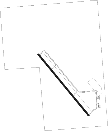
Runway info
| Runway 14 / 32 | ||
| length | 1007m (3304ft) | |
| bearing | 134° / 314° | |
| width | 23m (75ft) | |
| surface | asphalt | |
Nearby beacons
| code | identifier | dist | bearing | frequency |
|---|---|---|---|---|
| XCR | RIPLEY NDB | 26.4 | 123° | 404 |
| PK | SPIDA (PARK RAPIDS) NDB | 28 | 340° | 269 |
| AXN | ALEXANDRIA VOR/DME | 30.9 | 225° | 112.80 |
| BR | LAREW (BRAINERD) NDB | 32.7 | 84° | 251 |
| PKD | RAPIDS DME | 32.9 | 333° | 110.60 |
| STC | SAINT CLOUD VOR/DME | 58.8 | 138° | 112.10 |
| ST | HUSSK (ST CLOUD) NDB | 64.4 | 137° | 342 |
Instrument approach procedures
| runway | airway (heading) | route (dist, bearing) |
|---|---|---|
| RW14 | CUCAC (244°) | CUCAC HUDLA (22mi, 267°) 3100ft HUDLA (turn) 3000ft |
| RW14 | OHJAY (111°) | OHJAY HUDLA (16mi, 98°) 3000ft |
| RNAV | HUDLA 3000ft ZUDIP (6mi, 134°) 3000ft ZEPOB (4mi, 134°) 1860ft KSAZ (2mi, 134°) 1328ft (5604mi, 116°) 1640ft WUSMI (5601mi, 296°) HULVO (6mi, 152°) 3000ft HULVO (turn) | |
| RW32 | CUCAC (244°) | CUCAC HULVO (24mi, 216°) 3100ft HULVO (turn) 3000ft |
| RW32 | MAFLN (332°) | MAFLN HULVO (11mi, 342°) 3000ft |
| RNAV | HULVO 3000ft WUSMI (6mi, 332°) 3000ft KSAZ (6mi, 314°) 1325ft (5604mi, 116°) 1592ft HUDLA (5610mi, 296°) 3000ft HUDLA (turn) |
Disclaimer
The information on this website is not for real aviation. Use this data with the X-Plane flight simulator only! Data taken with kind consent from X-Plane 12 source code and data files. Content is subject to change without notice.