Chillicothe - Ross Co
Airport details
| Country | United States of America |
| State | Ohio |
| Region | K5 |
| Airspace | Indianapolis Ctr |
| Municipality | Ross County |
| Elevation | 725ft (221m) |
| Timezone | GMT -5 |
| Coordinates | 39.44042, -83.02306 |
| Magnetic var | |
| Type | land |
| Available since | X-Plane v10.40 |
| ICAO code | KRZT |
| IATA code | n/a |
| FAA code | RZT |
Communication
| Ross Co AWOS 3 | 119.225 |
| Ross Co CTAF/UNICOM | 122.800 |
| Ross Co COLUMBUS Approach/Departure | 132.300 |
Nearby Points of Interest:
Adena Mound
-Adena Mansion
-Levi Anderson House
-Mount Oval
-Seip House
-Bellevue
-Chillicothe Water and Power Company Pumping Station
-Anthony and Susan Cardinal Walke House
-Vanmeter Church Street House
-Mountain House (Chillicothe, Ohio)
-Canal Warehouse
-Oak Hill
-Tanglewood
-Renick House
-Mary Worthington Macomb House
-Luthor List Mound
-Applethorpe Farm
-Arledge Mounds I and II
-Morris House (Circleville, Ohio)
-Ansel T. Walling House
-William Marshall Anderson House
-Gill-Morris Farm
-Watt-Groce-Fickhardt House
-Matthew McCrea House
-Redlands
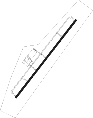
Runway info
| Runway 5 / 23 | ||
| length | 1647m (5404ft) | |
| bearing | 50° / 230° | |
| width | 30m (100ft) | |
| surface | asphalt | |
| blast zone | 169m (554ft) / 0m (0ft) | |
Nearby beacons
| code | identifier | dist | bearing | frequency |
|---|---|---|---|---|
| XUB | YELLOW BUD (CIRCLEVILLE) VOR | 5.5 | 28° | 112.50 |
| EOP | WAVERLY NDB | 16.9 | 161° | 385 |
| DD | COBBS (COLUMBUS) NDB | 18.1 | 1° | 253 |
| CSS | COURT HOUSE (WASHINGTON) NDB | 19.6 | 294° | 414 |
| LCK | RICKENBACKER (COLUMBUS) TACAN | 22.5 | 14° | 134.20 |
| BU | BOUTN (COLUMBUS) NDB | 24.2 | 334° | 230 |
| LC | PICKL (COLUMBUS) NDB | 27.8 | 23° | 376 |
| IL | AIRBO (WILMINGTON) NDB | 33.3 | 274° | 407 |
| MXQ | MIDWEST (WILMINGTON) VOR/DME | 36.1 | 269° | 112.90 |
| OS | FULER (COLUMBUS) NDB | 38.8 | 345° | 515 |
| HW | CUBLA (WILMINGTON) NDB | 39.9 | 264° | 299 |
| UGS | UNIVERSITY (ATHENS) NDB | 43 | 102° | 250 |
| XSF | SPRINGFIELD TACAN | 44.7 | 296° | 133.80 |
| SGH | DME | 44.8 | 296° | 113.20 |
| APE | APPLETON VORTAC | 47.1 | 31° | 116.70 |
| YRK | YORK VORTAC | 47.8 | 177° | 112.80 |
| HNN | DME | 62.1 | 125° | 115.90 |
Instrument approach procedures
| runway | airway (heading) | route (dist, bearing) |
|---|---|---|
| RW23 | DEYAY (202°) | DEYAY 3000ft JONEX (7mi, 146°) 3000ft |
| RW23 | JEVMU (252°) | JEVMU 3000ft JONEX (7mi, 288°) 3000ft |
| RW23 | JONEX (230°) | JONEX 3000ft |
| RNAV | JONEX 3000ft KEFLI (6mi, 230°) 2400ft WUNRO (2mi, 230°) 1700ft KRZT (3mi, 230°) 750ft (5082mi, 115°) 1500ft JONEX (5075mi, 296°) 3000ft JONEX (turn) |
Disclaimer
The information on this website is not for real aviation. Use this data with the X-Plane flight simulator only! Data taken with kind consent from X-Plane 12 source code and data files. Content is subject to change without notice.