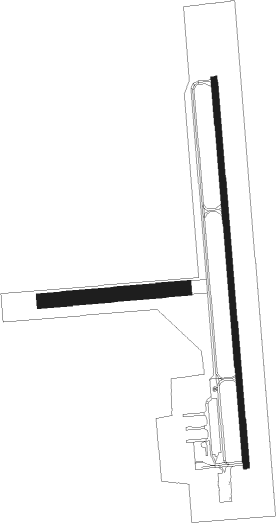
Rensselaer - Jasper Co
Airport details
| Country | United States of America |
| State | Indiana |
| Region | K5 |
| Airspace | Chicago Ctr |
| Municipality | Jasper County |
| Elevation | 698ft (213m) |
| Timezone | GMT -6 |
| Coordinates | 40.94783, -87.18265 |
| Magnetic var | |
| Type | land |
| Available since | X-Plane v10.40 |
| ICAO code | KRZL |
| IATA code | RNZ |
| FAA code | RZL |
Communication
| Jasper Co CTAF/UNICOM | 122.800 |
Nearby Points of Interest:
Rensselaer Carnegie Library
-Oren F. and Adelia Parker House
-Rensselaer Courthouse Square Historic District
-Jasper County Courthouse
-Charles Halleck Student Center
-Schwietermann Hall
-St. Joseph Indian Normal School
-Hugh and Leona Rank House
-George Ade House
-Fountain Park Chautauqua
-McCairn-Turner House
-Goodland-Grant Township Public Library
-Scott-Lucas House
-Mallon Building
-Monon Commercial Historic District
-Newton County Courthouse
-Benton County Courthouse
-Fraser & Isham Law Office
-White County Asylum
-St. Mary's Church
-Buckley Homestead
-Eli Sigler House
-Prairie Dell Meetinghouse
-James Culbertson Reynolds House
-Monticello Carnegie Library

Nearby beacons
| code | identifier | dist | bearing | frequency |
|---|---|---|---|---|
| BVT | BOILER (LAFAYETTE) VORTAC | 24 | 164° | 115.10 |
| IKK | DME | 31.1 | 281° | 111.60 |
| LA | EARLE (LAFAYETTE) NDB | 31.8 | 166° | 401 |
| IK | LUKOW (KANKAKEE) NDB | 32.9 | 276° | 272 |
| OXI | KNOX VOR/DME | 32.9 | 55° | 115.60 |
| VP | SEDLY (VALPARAISO) NDB | 33.2 | 31° | 212 |
| EON | PEOTONE VORTAC | 33.6 | 298° | 113.20 |
| CGT | CHICAGO HEIGHTS VORTAC | 38 | 325° | 114.20 |
| GY | GARIE (GARY) NDB | 38 | 347° | 236 |
| DN | JULIP (DANVILLE) NDB | 42.5 | 208° | 332 |
| DNV | DANVILLE VORTAC | 42.8 | 210° | 111 |
| RBS | ROBERTS VOR/DME | 49.7 | 250° | 116.80 |
| MX | KEDZI (CHICAGO) NDB | 52.8 | 327° | 248 |
| CFJ | CRAWFORDSVILLE NDB | 59.3 | 165° | 388 |
| GIJ | GIPPER (NILES) VORTAC | 62.8 | 46° | 115.40 |
| SB | MISHA (SOUTH BEND) NDB | 62.9 | 52° | 341 |
| CM | VEALS (CHAMPAIGN/URBANA) NDB | 74.5 | 226° | 407 |
Instrument approach procedures
| runway | airway (heading) | route (dist, bearing) |
|---|---|---|
| RW18 | JITVI (180°) | JITVI 2600ft |
| RW18 | LUCIT (140°) | LUCIT JITVI (12mi, 109°) 2600ft |
| RW18 | MAPPS (226°) | MAPPS JITVI (11mi, 262°) 2600ft |
| RNAV | JITVI 2600ft WIRAG (7mi, 180°) 2400ft CUJBA (4mi, 180°) 1240ft KRZL (2mi, 182°) 738ft (5277mi, 115°) 948ft WUPAL (5277mi, 295°) 2600ft WUPAL (turn) | |
| RW36 | BOSSY (30°) | BOSSY WUPAL (9mi, 70°) 2600ft |
| RW36 | BVT (344°) | BVT WUPAL (11mi, 325°) 2600ft |
| RW36 | WUPAL (359°) | WUPAL 2600ft |
| RNAV | WUPAL 2600ft ZOMDO (9mi, 360°) 2400ft CETEM (4mi, 360°) 1240ft KRZL (2mi, 358°) 714ft (5277mi, 115°) 924ft JITVI (5278mi, 295°) 2600ft JITVI (turn) |
Disclaimer
The information on this website is not for real aviation. Use this data with the X-Plane flight simulator only! Data taken with kind consent from X-Plane 12 source code and data files. Content is subject to change without notice.