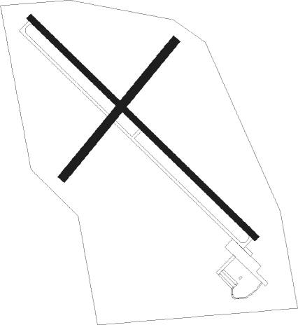
Warroad - Warroad Intl Swede Carlson Field
Airport details
| Country | United States of America |
| State | Minnesota |
| Region | K3 |
| Airspace | Minneapolis Ctr |
| Municipality | Warroad |
| Elevation | 1074ft (327m) |
| Timezone | GMT -6 |
| Coordinates | 48.94147, -95.34847 |
| Magnetic var | |
| Type | land |
| Available since | X-Plane v10.40 |
| ICAO code | KRRT |
| IATA code | RRT |
| FAA code | RRT |
Communication
| WARROAD INTL SWEDE CARLSON FIELD AWOS 3 | 119.925 |
| WARROAD INTL SWEDE CARLSON FIELD CTAF/UNICOM | 123.050 |
Approach frequencies
| ILS-cat-I | RW31 | 110.1 | 18.00mi |
| 3° GS | RW31 | 110.1 | 18.00mi |
Nearby beacons
| code | identifier | dist | bearing | frequency |
|---|---|---|---|---|
| SW | ROADD (WARROAD) NDB | 6.3 | 126° | 360 |
| ROX | ROSEAU VOR/DME | 14.6 | 256° | 108.80 |
| BDE | DME | 32.1 | 106° | 111.60 |
| TVF | THIEF RIVER FALLS VOR/DME | 62 | 224° | 114.45 |
| YQK | KENORA NDB | 62.5 | 47° | 326 |
Instrument approach procedures
| runway | airway (heading) | route (dist, bearing) |
|---|---|---|
| RW13 | HAPKO (127°) | HAPKO 3000ft |
| RW13 | JOVIN (174°) | JOVIN HAPKO (9mi, 240°) 3000ft |
| RW13 | TEVPE (104°) | TEVPE HAPKO (6mi, 60°) 3000ft |
| RNAV | HAPKO 3000ft DUSEC (7mi, 127°) 2700ft WEPVO (3mi, 127°) 1740ft KRRT (2mi, 127°) 1118ft (5616mi, 117°) 1276ft EPAME (5608mi, 297°) 3000ft EPAME (turn) | |
| RW31 | EPAME (307°) | EPAME 3000ft |
| RW31 | FAPAK (332°) | FAPAK EPAME (5mi, 60°) 3000ft |
| RW31 | GAYCE (288°) | GAYCE EPAME (5mi, 240°) 3000ft |
| RNAV | EPAME 3000ft DULPE (6mi, 307°) 3000ft KRRT (6mi, 307°) 1119ft (5616mi, 117°) 1326ft HAPKO (5623mi, 297°) 3000ft HAPKO (turn) |
Disclaimer
The information on this website is not for real aviation. Use this data with the X-Plane flight simulator only! Data taken with kind consent from X-Plane 12 source code and data files. Content is subject to change without notice.

