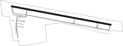
Rochester - Fulton County In
Airport details
| Country | United States of America |
| State | Indiana |
| Region | K5 |
| Airspace | Chicago Ctr |
| Municipality | Rochester |
| Elevation | 785ft (239m) |
| Timezone | GMT -5 |
| Coordinates | 41.06555, -86.18170 |
| Magnetic var | |
| Type | land |
| Available since | X-Plane v10.40 |
| ICAO code | KRCR |
| IATA code | RCR |
| FAA code | RCR |
Communication
| Fulton County IN AWOS 3 | 118.775 |
| Fulton County IN CTAF/UNICOM | 122.700 |
| Fulton County IN Power Freq | 128.800 |
| Fulton County IN SOUTH BEND Approach/Departure | 132.050 |
Nearby beacons
| code | identifier | dist | bearing | frequency |
|---|---|---|---|---|
| GUS | GRISSOM (PERU) VORTAC | 25.2 | 176° | 108.45 |
| OXI | KNOX VOR/DME | 26.1 | 299° | 115.60 |
| GSH | GOSHEN VORTAC | 28.4 | 18° | 113.70 |
| OKK | KOKOMO VORTAC | 32.7 | 167° | 113.50 |
| OLK | WEBSTER LAKE VOR | 32.8 | 75° | 110.40 |
| SB | MISHA (SOUTH BEND) NDB | 38.4 | 357° | 341 |
| VP | SEDLY (VALPARAISO) NDB | 39 | 299° | 212 |
| MZZ | MARION VOR/DME | 41.2 | 139° | 108.60 |
| GIJ | GIPPER (NILES) VORTAC | 42.6 | 349° | 115.40 |
| FWA | FORT WAYNE VORTAC | 45.3 | 95° | 117.80 |
| BVT | BOILER (LAFAYETTE) VORTAC | 50.6 | 240° | 115.10 |
| LA | EARLE (LAFAYETTE) NDB | 55.1 | 234° | 401 |
| IRS | STURGIS NDB | 56.1 | 45° | 382 |
| MIE | MUNCIE VOR/DME | 61.3 | 136° | 114.40 |
| JN | BALLL (MUNCIE) NDB | 66 | 136° | 365 |
| MI | BALLL (MUNCIE) NDB | 66 | 136° | 365 |
| AI | VIDEO (ANDERSON) NDB | 67.1 | 146° | 394 |
Instrument approach procedures
| runway | airway (heading) | route (dist, bearing) |
|---|---|---|
| RW11 | ISOSY (84°) | ISOSY 3000ft KOMEC (5mi, 19°) 3000ft |
| RW11 | KOMEC (101°) | KOMEC 3000ft |
| RW11 | LIMEY (121°) | LIMEY 3000ft KOMEC (5mi, 199°) 3000ft |
| RNAV | KOMEC 3000ft AFAGU (6mi, 101°) 2500ft VOYUP (3mi, 101°) 1600ft KRCR (3mi, 102°) 832ft LOWTO (12mi, 102°) 3000ft LOWTO (turn) | |
| RW29 | FAREM (301°) | FAREM 3000ft LOWTO (5mi, 20°) 3000ft |
| RW29 | LOWTO (282°) | LOWTO 3000ft |
| RW29 | TAFME (264°) | TAFME 3000ft LOWTO (5mi, 200°) 3000ft |
| RNAV | LOWTO 3000ft JETTR (6mi, 282°) 2500ft OYIPI (3mi, 282°) 1600ft KRCR (3mi, 282°) 833ft KOMEC (12mi, 281°) 3000ft KOMEC (turn) |
Disclaimer
The information on this website is not for real aviation. Use this data with the X-Plane flight simulator only! Data taken with kind consent from X-Plane 12 source code and data files. Content is subject to change without notice.
