Pittsburg - Atkinson Muni
Airport details
| Country | United States of America |
| State | Kansas |
| Region | K3 |
| Airspace | Kansas City Ctr |
| Municipality | Pittsburg |
| Elevation | 950ft (290m) |
| Timezone | GMT -6 |
| Coordinates | 37.44947, -94.73114 |
| Magnetic var | |
| Type | land |
| Available since | X-Plane v10.40 |
| ICAO code | KPTS |
| IATA code | n/a |
| FAA code | PTS |
Communication
| Atkinson Muni AWOS 3 | 118.775 |
| Atkinson Muni CTAF/UNICOM | 123.000 |
Nearby Points of Interest:
Pittsburg Public Library
-St. John's Episcopal Church
-First Presbyterian Church
-Harry S Truman Birthplace State Historic Site
-Downtown Webb City Historic District
-Williams' Store
-Edgar Backus Schermerhorn House
-First Congregational Church
-Fort Scott National Cemetery
-Ridgway Apartments
-Gentry Apartments
-South Main Street Historic District
-Olivia Apartments
-Joplin Supply Company
-Fox Theatre
-Elks Club Lodge No. 501
-Fifth and Main Historic District
-Scottish Rite Cathedral
-Joplin Downtown Historic District
-St. Louis and San Francisco Railroad Building
-Newman Brothers Building
-Joplin Carnegie Library
-Main and Eighth Streets Historic District
-Inter-State Grocer Company Building
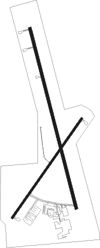
Runway info
Runway 17 / 35  | ||
| length | 1863m (6112ft) | |
| bearing | 167° / 347° | |
| width | 30m (100ft) | |
| surface | asphalt | |
| Runway 4 / 22 | ||
| length | 1220m (4003ft) | |
| bearing | 46° / 226° | |
| width | 23m (75ft) | |
| surface | asphalt | |
Nearby beacons
| code | identifier | dist | bearing | frequency |
|---|---|---|---|---|
| JL | LUNNS (JOPLIN) NDB | 16.9 | 145° | 344 |
| OSW | OSWEGO VOR/DME | 28.5 | 238° | 117.60 |
| EOS | NEOSHO VOR/DME | 39.1 | 154° | 117.30 |
| CNU | CHANUTE VOR/DME | 42.4 | 282° | 109.20 |
| BUM | BUTLER VORTAC | 50.7 | 16° | 115.90 |
Instrument approach procedures
| runway | airway (heading) | route (dist, bearing) |
|---|---|---|
| RW04 | EXORY (46°) | EXORY 3100ft |
| RW04 | JETIP (3°) | JETIP EXORY (9mi, 304°) 3100ft |
| RW04 | OSW (58°) | OSW EXORY (17mi, 67°) 3100ft |
| RNAV | EXORY 3100ft BIDPY (7mi, 46°) 2600ft PAYRU (3mi, 46°) 1520ft KPTS (2mi, 45°) 986ft (5631mi, 112°) 1196ft ZIBMO (5622mi, 292°) 3000ft ZIBMO (turn) | |
| RW17 | BIKNL (167°) | BIKNL NAMEZ (8mi, 167°) 3000ft |
| RW17 | NAMEZ (168°) | NAMEZ 3000ft |
| RNAV | NAMEZ 3000ft NMBRS (7mi, 167°) 2600ft YLLOW (3mi, 167°) 1540ft KPTS (2mi, 169°) 976ft (5631mi, 112°) 1216ft PAGEZ (5629mi, 291°) 3100ft PAGEZ (turn) | |
| RW22 | YUGTU (227°) | YUGTU ZIBMO (7mi, 226°) 3000ft |
| RW22 | ZEDDI (272°) | ZEDDI ZIBMO (19mi, 298°) 3000ft |
| RW22 | ZIBMO (227°) | ZIBMO 3000ft |
| RNAV | ZIBMO 3000ft HIBUX (7mi, 226°) 2600ft ZOPQE (3mi, 226°) 1560ft KPTS (2mi, 228°) 962ft (5631mi, 112°) 1300ft EXORY (5639mi, 291°) 3100ft EXORY (turn) | |
| RW35 | HOFMN (15°) | HOFMN PAGEZ (7mi, 56°) 3100ft |
| RW35 | PAGEZ (347°) | PAGEZ 3100ft |
| RW35 | WACCO (327°) | WACCO PAGEZ (7mi, 297°) 3100ft |
| RNAV | PAGEZ 3100ft KBROK (6mi, 347°) 2600ft KPTS (6mi, 347°) 967ft (5631mi, 112°) 1179ft NAMEZ (5632mi, 292°) 3000ft NAMEZ (turn) |
Disclaimer
The information on this website is not for real aviation. Use this data with the X-Plane flight simulator only! Data taken with kind consent from X-Plane 12 source code and data files. Content is subject to change without notice.