Fayetteville - Pope Aaf
Airport details
| Country | United States of America |
| State | North Carolina |
| Region | K7 |
| Airspace | Washington Ctr |
| Municipality | Cumberland County |
| Elevation | 215ft (66m) |
| Timezone | GMT -5 |
| Coordinates | 35.17089, -79.01450 |
| Magnetic var | |
| Type | land |
| Available since | X-Plane v10.40 |
| ICAO code | KPOB |
| IATA code | POB |
| FAA code | POB |
Communication
| Pope AAF ATIS | 132.300 |
| Pope AAF Ground Control | 124.550 |
| Pope AAF Tower | 135.025 |
| Pope AAF FAYETTEVILLE Approach/Departure | 125.175 |
| Pope AAF FAYETTEVILLE Approach/Departure | 133.000 |
Approach frequencies
| ILS-cat-I | RW23 | 110.9 | 18.00mi |
| 3° GS | RW23 | 110.9 | 18.00mi |
Nearby Points of Interest:
North Durham County Prison Camp
-Ellerslie
-Confederate Breastworks
-Fayetteville Veterans Administration Hospital Historic District
-Frank H. Stedman House
-Brownlea
-Dr. William C. Verdery House
-McCall House
-Holt-Harrison House
-Orange Street School
-Barge's Tavern
-Belden-Horne House
-M & O Chevrolet Company
-Phoenix Masonic Lodge No. 8
-Fayetteville Mutual Insurance Company Building
-Mansard Roof House
-The Capitol
-St. Joseph's Episcopal Church
-Cape Fear and Yadkin Valley Railway Passenger Depot
-Waddill's Store
-Kyle House
-St. John's Episcopal Church
-Market House Square District
-Fayetteville Downtown Historic District
-Cumberland County Courthouse
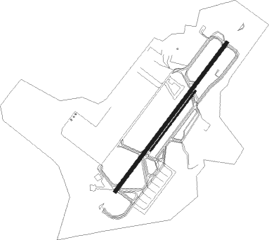
Runway info
Runway 5 / 23  | ||
| length | 2287m (7503ft) | |
| bearing | 47° / 227° | |
| width | 46m (150ft) | |
| surface | asphalt | |
| blast zone | 255m (837ft) / 255m (837ft) | |
| Runway 5R / 23L | ||
| length | 915m (3002ft) | |
| bearing | 47° / 227° | |
| width | 18m (60ft) | |
| surface | asphalt | |
Nearby beacons
| code | identifier | dist | bearing | frequency |
|---|---|---|---|---|
| POB | POPE (FAYETTEVILLE) TACAN | 0.2 | 244° | 113.80 |
| POB | POPE (FAYETTEVILLE) NDB | 4.4 | 47° | 338 |
| FGP | FORT BRAGG NDB | 10 | 99° | 393 |
| FAY | FAYETTEVILLE VOR/DME | 13 | 143° | 108.80 |
| HQT | HARNETT (ERWIN) NDB | 22.9 | 52° | 417 |
| SDZ | SANDHILLS (SOUTHERN PINES VORTAC | 28.2 | 274° | 111.80 |
| ME | MAXTN (MAXTON) NDB | 33.7 | 224° | 257 |
| CTZ | CLINTON NDB | 34.1 | 107° | 412 |
| JN | JURLY (SMITHFIELD) NDB | 34.1 | 63° | 263 |
| JB | JIGEL (LUMBERTON) NDB | 38 | 191° | 384 |
| RDU | RALEIGH-DURHAM VORTAC | 43.6 | 18° | 117.20 |
| DLC | DILLON NDB | 46.6 | 206° | 274 |
| LE | LEEVY (RALEIGH/DURHAM) NDB | 47.6 | 21° | 350 |
| LIB | LIBERTY VORTAC | 48.3 | 317° | 113 |
| BES | BENNETTSVILLE NDB | 48.4 | 233° | 230 |
| CPC | CAMP (WHITEVILLE) NDB | 55.9 | 161° | 227 |
| HB | ALAMM NDB | 55.9 | 325° | 361 |
| UDG | DARLINGTON NDB | 61.3 | 230° | 245 |
| FLO | FLORENCE VORTAC | 64.6 | 214° | 115.20 |
| GSO | GREENSBORO VORTAC | 70.4 | 312° | 116.20 |
| FL | ALCOT (FLORENCE) NDB | 72.7 | 220° | 335 |
Instrument approach procedures
| runway | airway (heading) | route (dist, bearing) |
|---|---|---|
| RW23 | ACENO (227°) | ACENO 2000ft |
| RNAV | ACENO 2000ft NAYIN (7mi, 227°) 1500ft KPOB (5mi, 227°) 244ft (4867mi, 114°) 680ft AWGUS (4875mi, 294°) 2000ft AWGUS (turn) 9000ft |
Disclaimer
The information on this website is not for real aviation. Use this data with the X-Plane flight simulator only! Data taken with kind consent from X-Plane 12 source code and data files. Content is subject to change without notice.