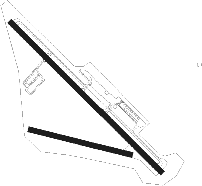
New Philadelphia - Harry Clever Fld
Airport details
| Country | United States of America |
| State | Ohio |
| Region | K5 |
| Airspace | Cleveland Ctr |
| Municipality | New Philadelphia |
| Elevation | 894ft (272m) |
| Timezone | GMT -5 |
| Coordinates | 40.47017, -81.41994 |
| Magnetic var | |
| Type | land |
| Available since | X-Plane v10.40 |
| ICAO code | KPHD |
| IATA code | PHD |
| FAA code | PHD |
Communication
| Harry Clever Fld ASOS | 121.425 |
| Harry Clever Fld CTAF/UNICOM | 122.800 |
| Harry Clever Fld AKRON CANTON Approach/Departure | 125.500 |
Nearby beacons
| code | identifier | dist | bearing | frequency |
|---|---|---|---|---|
| CTW | DME | 14.7 | 193° | 111.80 |
| BSV | BRIGGS VOR/DME | 16.2 | 357° | 112.40 |
| CFX | CADIZ NDB | 23.3 | 120° | 239 |
| AK | AKRON NDB | 36 | 3° | 362 |
| ZZV | ZANESVILLE VOR/DME | 38.4 | 222° | 114.95 |
| AIR | BELLAIRE VOR/DME | 38.7 | 127° | 117.10 |
| ACO | AKRON VOR/DME | 39.5 | 19° | 114.40 |
| HLG | WHEELING VOR/DME | 40.9 | 104° | 112.20 |
| YN | FETCH (YOUNGSTOWN/WARREN) NDB | 57.6 | 48° | 338 |
| YNG | YOUNGSTOWN VORTAC | 61.7 | 41° | 109 |
| DJB | DRYER VOR/DME | 63 | 320° | 113.60 |
Instrument approach procedures
| runway | airway (heading) | route (dist, bearing) |
|---|---|---|
| RW15 | CEPSI (150°) | CEPSI EPIBY (5mi, 205°) 3000ft |
| RW15 | EPIBY (132°) | EPIBY 3000ft |
| RW15 | ZETMU (114°) | ZETMU EPIBY (7mi, 89°) 3000ft |
| RNAV | EPIBY 3000ft TOSDE (7mi, 131°) 2600ft KPHD (4mi, 132°) 934ft (5014mi, 116°) 1294ft HIMEL (5011mi, 296°) 3000ft HIMEL (turn) 3000ft | |
| RW33 | ZUDGI (312°) | ZUDGI 6000ft ZUDGI (turn) 3000ft |
| RNAV | ZUDGI 3000ft JOGRO (9mi, 312°) 2600ft KPHD (4mi, 311°) 940ft (5014mi, 116°) 1294ft EPIBY (5022mi, 296°) 3000ft EPIBY (turn) |
Disclaimer
The information on this website is not for real aviation. Use this data with the X-Plane flight simulator only! Data taken with kind consent from X-Plane 12 source code and data files. Content is subject to change without notice.

