Ottawa - Putnam Co
Airport details
| Country | United States of America |
| State | Ohio |
| Region | K5 |
| Airspace | Cleveland Ctr |
| Municipality | Blanchard Township |
| Elevation | 763ft (233m) |
| Timezone | GMT -5 |
| Coordinates | 41.03558, -83.98192 |
| Magnetic var | |
| Type | land |
| Available since | X-Plane v10.40 |
| ICAO code | KOWX |
| IATA code | n/a |
| FAA code | OWX |
Communication
| PUTNAM CO AWOS 3 | 120.525 |
| PUTNAM CO CTAF/UNICOM | 122.700 |
| PUTNAM CO TOLEDO Approach/Departure | 120.800 |
Nearby Points of Interest:
Ottawa Waterworks Building
-Putnam County Courthouse
-Dr. H. Huber Block
-Leipsic Village Hall
-John Edwards House
-Adams School
-First Hancock County Courthouse
-Ada Pennsylvania Station and Railroad Park
-Lima Pennsylvania Railroad Passenger Depot
-Round Barn
-Klaus Block
-Renz Block
-Metropolitan Block
-Elks Lodge
-Allen County Courthouse
-Ohio Theatre
-Neal Clothing Building
-U.S. Post Office
-First National Bank and Trust Building
-Union Block
-Beck and R.C. Cahill Buildings
-Martin and Kibby Blocks
-Allen County Museum
-Dorsey Building
-Linneman Building
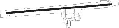
Runway info
| Runway 9 / 27 | ||
| length | 1369m (4491ft) | |
| bearing | 90° / 270° | |
| width | 23m (75ft) | |
| surface | asphalt | |
| displ threshold | 0m (0ft) / 12m (39ft) | |
Nearby beacons
| code | identifier | dist | bearing | frequency |
|---|---|---|---|---|
| FBC | FLAG CITY VORTAC | 11.3 | 110° | 108.20 |
| TO | TOPHR (TOLEDO) NDB | 31.2 | 7° | 219 |
| TOL | TOLEDO TACAN | 34.5 | 18° | 112.50 |
| TII | TIFFIN NDB | 34.9 | 86° | 269 |
| ROD | ROSEWOOD VORTAC | 44.9 | 185° | 117.50 |
| GW | SHENK (AUBURN) NDB | 46.4 | 286° | 227 |
| BUD | BUCKEYE (MARION) VOR | 48.7 | 115° | 109.80 |
| ADG | ADRIAN NDB | 50.2 | 353° | 278 |
| TCU | TECUMSEH NDB | 60.1 | 5° | 239 |
| AWW | WINCHESTER NDB | 67.4 | 227° | 212 |
| OS | FULER (COLUMBUS) NDB | 67.9 | 141° | 515 |
Instrument approach procedures
| runway | airway (heading) | route (dist, bearing) |
|---|---|---|
| RW09 | TWERP (102°) | TWERP WIFES (14mi, 113°) 3000ft |
| RW09 | WIFES (90°) | WIFES 3000ft |
| RNAV | WIFES 3000ft ZEBIR (6mi, 90°) 2500ft ILEDE (3mi, 90°) 1580ft KOWX (3mi, 90°) 794ft (5133mi, 116°) 1048ft CIVRO (5121mi, 296°) 3000ft CIVRO (turn) | |
| RW27 | CIVRO (270°) | CIVRO 3000ft |
| RW27 | DUSKY (279°) | DUSKY CIVRO (25mi, 283°) 3000ft |
| RNAV | CIVRO 3000ft HEMIC (6mi, 270°) 2500ft XEBXO (3mi, 270°) 1600ft KOWX (3mi, 270°) 807ft (5133mi, 116°) 1048ft WIFES (5145mi, 296°) 3000ft WIFES (turn) |
Disclaimer
The information on this website is not for real aviation. Use this data with the X-Plane flight simulator only! Data taken with kind consent from X-Plane 12 source code and data files. Content is subject to change without notice.