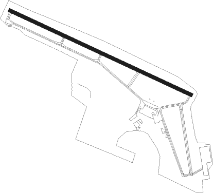
Winona - Winona Muni Max Conrad Fld
Airport details
| Country | United States of America |
| State | Minnesota |
| Region | K3 |
| Airspace | Minneapolis Ctr |
| Municipality | Winona |
| Elevation | 653ft (199m) |
| Timezone | GMT -6 |
| Coordinates | 44.07755, -91.70903 |
| Magnetic var | |
| Type | land |
| Available since | X-Plane v10.40 |
| ICAO code | KONA |
| IATA code | n/a |
| FAA code | ONA |
Communication
| WINONA MUNI MAX CONRAD FLD AWOS | 118.075 |
| WINONA MUNI MAX CONRAD FLD CTAF/UNICOM | 122.800 |
| WINONA MUNI MAX CONRAD FLD Tower Freq ATC | 128.800 |
Approach frequencies
| ILS-cat-I | RW30 | 109.35 | 18.00mi |
| 3° GS | RW30 | 109.35 | 18.00mi |
Nearby Points of Interest:
Winona and St. Peter Engine House
-Dr. J. W. S. Gallagher House
-Fugina House
-Abner F. Hodgins House
-Huff–Lamberton House
-Winona County Courthouse
-Winona Public Library
-Schlitz Hotel
-Laird, Norton Company Building
-Winona Masonic Temple
-Winona Savings Bank Building
-Choate Department Store
-Grain and Lumber Exchange Building
-Winona and St. Peter Railroad Freight House
-East Second Street Commercial Historic District
-Winona City Hall
-Winona Commercial Historic District
-Anger's Block
-Watkins Manor House
-Trinity Episcopal Church (Stockton, Minnesota)
-Watkins Incorporated
-Sugar Loaf Brewery
-Church of the Holy Trinity-Catholic
-Pickwick Mill
-William Hemmelberg House
Nearby beacons
| code | identifier | dist | bearing | frequency |
|---|---|---|---|---|
| ODI | NODINE VORTAC | 14.3 | 124° | 117.90 |
| LS | MINDI (LA CROSSE) NDB | 19.8 | 99° | 272 |
| LSE | CROSSE DME | 23 | 114° | 108.40 |
| RST | ROCHESTER VOR/DME | 42.2 | 252° | 112 |
| UKN | DME | 48.4 | 168° | 116.60 |
| EAU | EAU CLAIRE VORTAC | 50.2 | 16° | 113.65 |
| RG | REGUE (RED WING) NDB | 51 | 299° | 274 |
Instrument approach procedures
| runway | airway (heading) | route (dist, bearing) |
|---|---|---|
| RW12 | PEPME (112°) | PEPME 3600ft |
| RNAV | PEPME 3600ft JOSEB (5mi, 112°) 2400ft WUKPI (2mi, 112°) 1740ft KONA (4mi, 113°) 698ft (5479mi, 116°) 1056ft ALEYU (5469mi, 296°) 3500ft ALEYU (turn) | |
| RW30 | ALEYU (292°) | ALEYU 3500ft |
| RNAV | ALEYU 3500ft WABNY (6mi, 292°) 2400ft ZORMO (3mi, 292°) 1500ft KONA (3mi, 291°) 706ft (5479mi, 116°) 1800ft ALEYU (5469mi, 296°) 3500ft ALEYU (turn) |
Disclaimer
The information on this website is not for real aviation. Use this data with the X-Plane flight simulator only! Data taken with kind consent from X-Plane 12 source code and data files. Content is subject to change without notice.