Marion - Marion Muni
Airport details
| Country | United States of America |
| State | Indiana |
| Region | K5 |
| Airspace | Chicago Ctr |
| Municipality | Marion |
| Elevation | 857ft (261m) |
| Timezone | GMT -5 |
| Coordinates | 40.48992, -85.67978 |
| Magnetic var | |
| Type | land |
| Available since | X-Plane v10.40 |
| ICAO code | KMZZ |
| IATA code | MZZ |
| FAA code | MZZ |
Communication
| Marion Muni AWOS | 108.600 |
| Marion Muni CTAF/UNICOM | 122.700 |
| Marion Muni GRISSOM Approach | 121.050 |
| Marion Muni GRISSOM Departure | 121.050 |
Approach frequencies
| ILS-cat-I | RW04 | 111.7 | 18.00mi |
| 3° GS | RW04 | 111.7 | 18.00mi |
Nearby Points of Interest:
West Ward School
-Thompson-Ray House
-Gas City High School
-Marie Webster House
-Abijah C. Jay House
-J. Woodrow Wilson House
-Marion Downtown Commercial Historic District
-Grant County Jail and Sheriff's Residence
-Baldwin Addition Historic District
-Aaron Swayzee House
-J.W. Patterson House
-Dr. Richard Davis House
-Israel Jenkins House
-Joseph & Lucinda Thawley House
-Meshingomesia Cemetery and Indian School Historic District
-Converse Depot
-Converse-Jackson Township Public Library
-Hy-Red Gasoline Station
-First Presbyterian Church
-Blackford County Courthouse
-Hartford City Courthouse Square Historic District
-Chenoweth-Coulter Farm
-Mount Zion Methodist Episcopal Church (Eaton, Indiana)
-Gene Stratton-Porter Cabin (Rome City, Indiana)
-Job Garner-Jacob W. Miller House
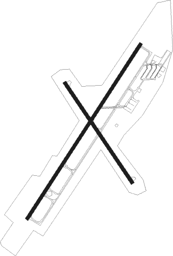
Runway info
Runway 4 / 22  | ||
| length | 1833m (6014ft) | |
| bearing | 45° / 225° | |
| width | 30m (98ft) | |
| surface | asphalt | |
| displ threshold | 7m (23ft) / 9m (30ft) | |
| Runway 15 / 33 | ||
| length | 1056m (3465ft) | |
| bearing | 143° / 323° | |
| width | 30m (98ft) | |
| surface | asphalt | |
| displ threshold | 0m (0ft) / 7m (23ft) | |
Nearby beacons
| code | identifier | dist | bearing | frequency |
|---|---|---|---|---|
| MZZ | MARION VOR/DME | 0.2 | 9° | 108.60 |
| OKK | KOKOMO VORTAC | 17.4 | 276° | 113.50 |
| MIE | MUNCIE VOR/DME | 20 | 131° | 114.40 |
| GUS | GRISSOM (PERU) VORTAC | 23.4 | 288° | 108.45 |
| JN | BALLL (MUNCIE) NDB | 24.7 | 131° | 365 |
| MI | BALLL (MUNCIE) NDB | 24.7 | 131° | 365 |
| AI | VIDEO (ANDERSON) NDB | 26.4 | 158° | 394 |
| FWA | FORT WAYNE VORTAC | 36.9 | 45° | 117.80 |
| UMP | METROPOLITAN (INDIANAPOLIS) NDB | 37.2 | 214° | 338 |
| AWW | WINCHESTER NDB | 39.7 | 113° | 212 |
| UWL | NEW CASTLE NDB | 40.2 | 149° | 385 |
| OLK | WEBSTER LAKE VOR | 46.2 | 14° | 110.40 |
| FV | LAREZ (INDIANAPOLIS) NDB | 48.4 | 216° | 349 |
| SQ | PNTHR (CONNERSVILLE) NDB | 49.7 | 142° | 227 |
| VHP | BRICKYARD VORTAC | 51.3 | 226° | 116.30 |
| SHB | SHELBYVILLE VOR/DME | 51.9 | 190° | 112 |
| CO | COLFA (INDIANAPOLIS) NDB | 55.1 | 211° | 232 |
| RID | RICHMOND VOR/DME | 58.6 | 131° | 110.60 |
| GW | SHENK (AUBURN) NDB | 59.4 | 42° | 227 |
| OXI | KNOX VOR/DME | 66.5 | 311° | 115.60 |
Instrument approach procedures
| runway | airway (heading) | route (dist, bearing) |
|---|---|---|
| RW04 | AKICA (45°) | AKICA 6000ft AKICA (turn) 3000ft |
| RW04 | PASEW (75°) | PASEW AKICA (13mi, 101°) 3000ft |
| RW04 | PENDS (5°) | PENDS AKICA (15mi, 327°) 3000ft |
| RNAV | AKICA 3000ft JOSKO (6mi, 45°) 3000ft CIVIL (4mi, 45°) 1860ft KMZZ (4mi, 46°) 910ft (5208mi, 115°) 1058ft BALAC (5201mi, 295°) 3000ft BALAC (turn) | |
| RW15 | FORCE (192°) | FORCE AGACI (10mi, 240°) 2500ft |
| RW15 | MZZ (189°) | MZZ AGACI (11mi, 323°) 2500ft AGACI (turn) 2500ft |
| RW15 | TROLY (119°) | TROLY AGACI (12mi, 99°) 2500ft |
| RNAV | AGACI 2500ft BIBAC (6mi, 143°) 2500ft KMZZ (5mi, 144°) 898ft (5208mi, 115°) 1300ft AKUYA (5202mi, 295°) 2500ft AKUYA (turn) | |
| RW22 | AJAYS (257°) | AJAYS BALAC (11mi, 285°) 2500ft |
| RW22 | BALAC (225°) | BALAC 6000ft BALAC (turn) 2500ft |
| RW22 | FORCE (192°) | FORCE BALAC (8mi, 139°) 2500ft |
| RNAV | BALAC 2500ft DUSEY (6mi, 225°) 2500ft ERUCT (3mi, 225°) 1480ft KMZZ (2mi, 225°) 902ft (5208mi, 115°) 1259ft AKICA (5215mi, 295°) 2700ft AKICA (turn) | |
| RW33 | AKUYA (323°) | AKUYA 6000ft AKUYA (turn) 2500ft |
| RW33 | HAROD (285°) | HAROD BACNA (6mi, 253°) 2500ft AKUYA (5mi, 247°) 2500ft |
| RW33 | PENDS (5°) | PENDS BICAD (11mi, 19°) 2500ft AKUYA (5mi, 66°) 2500ft |
| RNAV | AKUYA 2500ft AVACE (6mi, 323°) 2500ft KMZZ (5mi, 323°) 884ft (5208mi, 115°) 1259ft AGACI (5214mi, 295°) 2500ft AGACI (turn) |
Disclaimer
The information on this website is not for real aviation. Use this data with the X-Plane flight simulator only! Data taken with kind consent from X-Plane 12 source code and data files. Content is subject to change without notice.