Muscatine - Muscatine Muni
Airport details
| Country | United States of America |
| State | Iowa |
| Region | K3 |
| Airspace | Chicago Ctr |
| Municipality | Muscatine |
| Elevation | 545ft (166m) |
| Timezone | GMT -6 |
| Coordinates | 41.36789, -91.14822 |
| Magnetic var | |
| Type | land |
| Available since | X-Plane v10.40 |
| ICAO code | KMUT |
| IATA code | n/a |
| FAA code | MUT |
Communication
| MUSCATINE MUNI AWOS 3 | 119.775 |
| MUSCATINE MUNI CTAF/UNICOM | 122.700 |
| MUSCATINE MUNI QUAD CITY Clearance DEL | 124.250 |
| MUSCATINE MUNI QUAD CITY Approach/Departure | 118.200 |
Approach frequencies
| ILS-cat-I | RW24 | 109.15 | 18.00mi |
| 3° GS | RW24 | 109.15 | 18.00mi |
Nearby Points of Interest:
Greenwood Cemetery Chapel
-Clark-Blackwell House
-J. C. B. Warde House
-West Hill Historic District
-Alexander Clark House
-Welch Apartments
-Downtown Commercial Historic District
-Laura Musser McColm Historic District
-Muscatine County Courthouse
-W. Joseph Fuller House
-Old Jail
-Sinnett Octagon House
-Community Building
-Hotel Wapello
-Louisa County Courthouse
-Muscatine County Fairgrounds
-West Liberty Commercial Historic District
-George H. and Loretta Ward House
-James S. Thompson House
-Levi Willits House
-Gideon Ives House
-Toolesboro Mound Group
-Pine Mills German Methodist Episcopal Church
-Pine Creek Gristmill
-Pine Mill Bridge
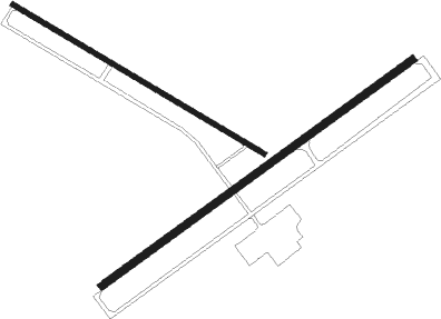
Runway info
Runway 6 / 24  | ||
| length | 1674m (5492ft) | |
| bearing | 65° / 245° | |
| width | 30m (100ft) | |
| surface | concrete | |
| blast zone | 61m (200ft) / 244m (801ft) | |
| Runway 12 / 30 | ||
| length | 1271m (4170ft) | |
| bearing | 118° / 298° | |
| width | 23m (75ft) | |
| surface | concrete | |
Nearby beacons
| code | identifier | dist | bearing | frequency |
|---|---|---|---|---|
| DDD | CITY DME | 0.1 | 214° | 116.50 |
| IOW | IOWA CITY VOR/DME | 22.8 | 288° | 116.20 |
| MZV | MOLINE VOR/DME | 23.1 | 95° | 114.40 |
| CVA | DAVENPORT VORTAC | 36.2 | 63° | 113.80 |
| BRL | BURLINGTON VOR/DME | 39.9 | 161° | 111.40 |
| FN | HILLZ (CLINTON) NDB | 41.1 | 63° | 517 |
| GBG | DME | 41.3 | 121° | 109.80 |
| CID | CEDAR RAPIDS VOR/DME | 42.3 | 309° | 114.10 |
| BR | BURNS (BURLINGTON) NDB | 42.8 | 178° | 390 |
| EOK | KEOKUK NDB | 55.7 | 198° | 366 |
| JZY | MACOMB NDB | 57.5 | 145° | 251 |
| DB | ZILOM (DUBUQUE) NDB | 62.4 | 30° | 341 |
Instrument approach procedures
| runway | airway (heading) | route (dist, bearing) |
|---|---|---|
| RW06 | DOVWE (43°) | DOVWE 3000ft IZBUF (5mi, 321°) 3000ft |
| RW06 | IZBUF (65°) | IZBUF 3000ft |
| RW06 | ZESHO (83°) | ZESHO 3300ft IZBUF (5mi, 141°) 3000ft |
| RNAV | IZBUF 3000ft LETCA (6mi, 65°) 2300ft KMUT (6mi, 64°) 590ft (5457mi, 114°) 947ft EDAGE (5447mi, 295°) 3000ft EDAGE (turn) | |
| RW12 | YEBTY (118°) | YEBTY 2600ft |
| RNAV | YEBTY 2600ft ZAVJO (6mi, 118°) 2200ft IXOBE (3mi, 118°) 1300ft KMUT (3mi, 118°) 580ft (5457mi, 114°) 947ft HOVRA (5448mi, 294°) 2700ft HOVRA (turn) | |
| RW24 | EDAGE (246°) | EDAGE 3000ft |
| RW24 | WILTI (224°) | WILTI 3300ft EDAGE (5mi, 141°) 3000ft |
| RW24 | ZAGES (264°) | ZAGES 3000ft EDAGE (5mi, 321°) 3000ft |
| RNAV | EDAGE 3000ft JOLIX (6mi, 245°) 2300ft YELDU (3mi, 245°) 1260ft KMUT (3mi, 248°) 596ft (5457mi, 114°) 812ft IZBUF (5467mi, 294°) 3000ft IZBUF (turn) | |
| RW30 | HOVRA (298°) | HOVRA 2700ft |
| RNAV | HOVRA 2700ft WONUM (6mi, 298°) 2300ft EMQIB (4mi, 298°) 1140ft KMUT (2mi, 297°) 583ft (5457mi, 114°) 743ft YEBTY (5466mi, 294°) 2600ft YEBTY (turn) |
Disclaimer
The information on this website is not for real aviation. Use this data with the X-Plane flight simulator only! Data taken with kind consent from X-Plane 12 source code and data files. Content is subject to change without notice.