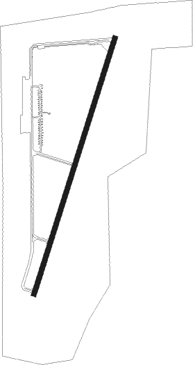
Dayton - Dayton Wright Brothers
Airport details
| Country | United States of America |
| State | Ohio |
| Region | K5 |
| Airspace | Indianapolis Ctr |
| Municipality | Miami Township |
| Elevation | 956ft (291m) |
| Timezone | GMT -5 |
| Coordinates | 39.58897, -84.22486 |
| Magnetic var | |
| Type | land |
| Available since | X-Plane v10.40 |
| ICAO code | KMGY |
| IATA code | MGY |
| FAA code | MGY |
Communication
| Dayton Wright Brothers ASOS | 118.375 |
| Dayton Wright Brothers CTAF/UNICOM | 122.800 |
| Dayton Wright Brothers Approach | 118.850 |
| Dayton Wright Brothers Departure | 126.500 |
Approach frequencies
| LOC | RW20 | 109.5 | 18.00mi |
Nearby beacons
| code | identifier | dist | bearing | frequency |
|---|---|---|---|---|
| MW | ONIDA (MIDDLETOWN) NDB | 4.6 | 264° | 223 |
| HKF | HOOK FIELD (MIDDLETOWN) NDB | 11.6 | 248° | 239 |
| FFO | PATTERSON (DAYTON) TACAN | 15.8 | 36° | 115.20 |
| AT | BRUNY (DAYTON) NDB | 16.3 | 337° | 315 |
| HW | CUBLA (WILMINGTON) NDB | 21.4 | 124° | 299 |
| MXQ | MIDWEST (WILMINGTON) VOR/DME | 21.8 | 111° | 112.90 |
| SGH | DME | 23 | 57° | 113.20 |
| IL | AIRBO (WILMINGTON) NDB | 23.2 | 101° | 407 |
| XSF | SPRINGFIELD TACAN | 23.2 | 57° | 133.80 |
| DQN | DAYTON VOR/DME | 26.8 | 338° | 114.50 |
| RID | RICHMOND VOR/DME | 30 | 285° | 110.60 |
| PWF | SPORTYS (BATAVIA) NDB | 30.7 | 179° | 245 |
| CSS | COURT HOUSE (WASHINGTON) NDB | 38.5 | 89° | 414 |
| CVG | CINCINNATI VORTAC | 40.9 | 220° | 117.30 |
| ROD | ROSEWOOD VORTAC | 42.7 | 15° | 117.50 |
| SQ | PNTHR (CONNERSVILLE) NDB | 43.3 | 282° | 227 |
| AWW | WINCHESTER NDB | 47.3 | 310° | 212 |
| FLM | FALMOUTH VOR/DME | 56.5 | 185° | 117 |
Departure and arrival routes
| Transition altitude | 18000ft |
| Transition level | 18000ft |
| STAR starting points | distance | inbound heading | |
|---|---|---|---|
| ALL | |||
| DANEI3 | 45.6 | 224° | |
Instrument approach procedures
| runway | airway (heading) | route (dist, bearing) |
|---|---|---|
| RW02 | ICALO (53°) | ICALO 3100ft SOVVO (5mi, 108°) 3100ft |
| RW02 | SOVVO (28°) | SOVVO 3100ft |
| RW02 | ZAVUM (358°) | ZAVUM 3100ft SOVVO (5mi, 288°) 3100ft |
| RNAV | SOVVO 3100ft JINEN (6mi, 28°) 2600ft KMGY (5mi, 28°) 985ft (5138mi, 115°) 1357ft WOBUL (5134mi, 295°) 3100ft WOBUL (turn) | |
| RW20 | HOSRI (178°) | HOSRI WOBUL (5mi, 108°) 3100ft |
| RW20 | SEYOS (233°) | SEYOS WOBUL (5mi, 288°) 3100ft |
| RW20 | WOBUL (208°) | WOBUL 3100ft |
| RNAV | WOBUL 3100ft TALAC (6mi, 208°) 2600ft KMGY (5mi, 208°) 995ft (5138mi, 115°) 1357ft SOVVO (5142mi, 295°) 3100ft SOVVO (turn) |
Holding patterns
| STAR name | hold at | type | turn | heading* | altitude | leg | speed limit |
|---|---|---|---|---|---|---|---|
| DANEI3 | DANEI | VHF | right | 73 (253)° | 1.0min timed | ICAO rules | |
| *) magnetic outbound (inbound) holding course | |||||||
Disclaimer
The information on this website is not for real aviation. Use this data with the X-Plane flight simulator only! Data taken with kind consent from X-Plane 12 source code and data files. Content is subject to change without notice.
