Harbor Springs
Airport details
| Country | United States of America |
| State | Michigan |
| Region | K5 |
| Airspace | Minneapolis Ctr |
| Municipality | Little Traverse Township |
| Elevation | 686ft (209m) |
| Timezone | GMT -5 |
| Coordinates | 45.42547, -84.91348 |
| Magnetic var | |
| Type | land |
| Available since | X-Plane v10.40 |
| ICAO code | KMGN |
| IATA code | n/a |
| FAA code | MGN |
Communication
| HARBOR SPRINGS AWOS 3 | 119.925 |
| HARBOR SPRINGS CTAF/UNICOM | 122.800 |
Nearby Points of Interest:
Bay View
-Shay Hexagon House
-Chief Andrew J. Blackbird House
-Grand Rapids and Indiana Railroad Harbor Springs Depot
-Petoskey Downtown Historic District
-G. W. Olin House
-Petoskey Public Works Utility Building
-George and Eugene Markle House
-Chesapeake and Ohio Depot
-J. B. Allen House
-Frank Schapler House
-Stout House
-Meyer Fryman House
-Seventh Day Adventist Church
-J. M. Wells House
-Jacob VanZolenburg House
-Petoskey Grocery Company Building
-George McManus House
-Trinity Evangelical Church
-Isaac Bartram House
-Gerhard Fochtman House
-Phillip Rehkopf House
-W. S. Carmichael House
-Jacob Miller House
-John Nyman House
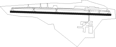
Runway info
| Runway 10 / 28 | ||
| length | 1262m (4140ft) | |
| bearing | 94° / 274° | |
| width | 23m (75ft) | |
| surface | asphalt | |
| displ threshold | 133m (436ft) / 135m (443ft) | |
Nearby beacons
| code | identifier | dist | bearing | frequency |
|---|---|---|---|---|
| PLN | PELLSTON VORTAC | 16.1 | 51° | 111.80 |
| GL | BANGU (GAYLORD) NDB | 25 | 166° | 375 |
| GLR | GAYLORD VOR/DME | 26.3 | 153° | 109.20 |
| GYG | GRAYLING NDB | 40.7 | 173° | 359 |
| CGG | GRAYLING VOR | 45.3 | 166° | 109.80 |
| TV | GWENN (TRAVERSE CITY) NDB | 46.9 | 217° | 365 |
| TVC | TRAVERSE CITY VOR/DME | 52.9 | 220° | 114.60 |
| CI | KOLOE (SAULT STE MARIE) NDB | 56.6 | 22° | 400 |
| SSM | SAULT STE MARIE VOR/DME | 64.3 | 31° | 112.20 |
Instrument approach procedures
| runway | airway (heading) | route (dist, bearing) |
|---|---|---|
| RW10 | OKPOQ (94°) | OKPOQ 3200ft |
| RW10 | WUQPU (113°) | WUQPU 3200ft OKPOQ (5mi, 188°) 3200ft |
| RW10 | YEKZU (77°) | YEKZU 3200ft OKPOQ (5mi, 8°) 3200ft |
| RNAV | OKPOQ 3200ft ZABVY (5mi, 94°) 2500ft HADEP (3mi, 94°) 1680ft KMGN (3mi, 94°) 713ft (5191mi, 118°) 1086ft SIJMI (5180mi, 298°) 3500ft SIJMI (turn) | |
| RW28 | SIJMI (274°) | SIJMI 3500ft |
| RW28 | VUPHI (293°) | VUPHI 3500ft SIJMI (5mi, 9°) 3500ft |
| RW28 | YANWU (257°) | YANWU 3500ft SIJMI (5mi, 189°) 3500ft |
| RNAV | SIJMI 3500ft ZEQNI (5mi, 274°) 2500ft EYOSE (2mi, 274°) 1680ft KMGN (3mi, 274°) 721ft (5191mi, 118°) 1086ft OPNOE (5193mi, 298°) JONIE (9mi, 244°) 3400ft JONIE (turn) |
Disclaimer
The information on this website is not for real aviation. Use this data with the X-Plane flight simulator only! Data taken with kind consent from X-Plane 12 source code and data files. Content is subject to change without notice.