Montgomery - Montgomery Regl
Airport details
| Country | United States of America |
| State | Alabama |
| Region | K7 |
| Airspace | Atlanta Ctr |
| Municipality | Montgomery |
| Elevation | 221ft (67m) |
| Timezone | GMT -6 |
| Coordinates | 32.30064, -86.39397 |
| Magnetic var | |
| Type | land |
| Available since | X-Plane v10.40 |
| ICAO code | KMGM |
| IATA code | MGM |
| FAA code | MGM |
Communication
| Montgomery Regl ATIS | 120.675 |
| Montgomery Regl CTAF | 119.700 |
| Montgomery Regl UNICOM | 122.950 |
| Montgomery Regl Clearance DEL | 118.300 |
| Montgomery Regl Ground Control | 121.700 |
| Montgomery Regl Tower | 119.700 |
| Montgomery Regl Approach/Departure | 118.850 |
| Montgomery Regl Approach/Departure | 121.200 |
| Montgomery Regl Approach/Departure | 124.000 |
| Montgomery Regl SFA | 122.850 |
| Montgomery Regl Approach/Departure | 132.450 |
Approach frequencies
| ILS-cat-I | RW28 | 108.5 | 18.00mi |
| ILS-cat-I | RW10 | 109.9 | 18.00mi |
| 3° GS | RW28 | 108.5 | 18.00mi |
| 3° GS | RW10 | 109.9 | 18.00mi |
Nearby Points of Interest:
Stone Plantation
-St. Jude Educational Institute
-Building 800-Austin Hall
-Simler Hall
-Cleveland Court Apartments 620–638
-Maxwell Air Force Base Senior Officers' Quarters Historic District
-Dr. C.A. Thigpen House
-Garden District
-Alabama Governor's Mansion
-McBryde-Screws-Tyson House
-Winter Place
-Gay House
-Cottage Hill Historic District
-Tyson-Maner House
-Sayre Street School
-Cloverdale Historic District
-Pepperman House
-Edgewood
-Frank M. Johnson, Jr., Federal Building and United States Courthouse
-Alabama State University Historic District
-Bell Building
-Union Station
-Court Square Historic District
-William Lowndes Yancey Law Office
-Gerald-Dowdell House
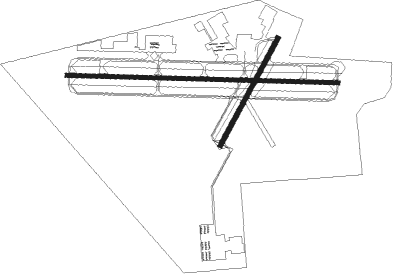
Runway info
Runway 10 / 28  | ||
| length | 2742m (8996ft) | |
| bearing | 95° / 275° | |
| width | 46m (151ft) | |
| surface | asphalt | |
| blast zone | 54m (177ft) / 48m (157ft) | |
| Runway 3 / 21 | ||
| length | 1224m (4016ft) | |
| bearing | 37° / 217° | |
| width | 46m (151ft) | |
| surface | asphalt | |
Nearby beacons
| code | identifier | dist | bearing | frequency |
|---|---|---|---|---|
| MXF | MAXWELL (MONTGOMERY) TACAN | 4.9 | 18° | 115 |
| MG | MARRA (MONTGOMERY) NDB | 5.9 | 275° | 245 |
| MGM | MONTGOMERY VORTAC | 6 | 137° | 112.10 |
| SE | POLLK (SELMA) NDB | 27.1 | 267° | 344 |
| TOI | BLOOD (TROY) NDB | 31.7 | 148° | 365 |
| TGE | TUSKEGEE VOR/DME | 38.3 | 76° | 117.30 |
| JUY | JUDD (ANDALUSIA) NDB | 59.7 | 180° | 264 |
| BVG | BOLL WEEVIL (ENTERPRISE) NDB | 61.4 | 157° | 352 |
| LOR | LOWE (FORT RUCKER) NDB | 65.4 | 145° | 269 |
| HYE | HANCHEY (FT RUCKER) NDB | 67.1 | 141° | 221 |
| HEY | HANCHEY (FT RUCKER) VOR | 67.2 | 141° | 110.60 |
| MVC | MONROEVILLE VORTAC | 70.3 | 229° | 116.80 |
| OKW | BROOKWOOD VORTAC | 70.9 | 318° | 111 |
Instrument approach procedures
| runway | airway (heading) | route (dist, bearing) |
|---|---|---|
| RW03 | RUNOE (36°) | RUNOE 3100ft |
| RNAV | RUNOE 3100ft WINUT (7mi, 37°) 2000ft ZUNRO (4mi, 37°) 740ft KMGM (2mi, 31°) 264ft (5222mi, 110°) 900ft RUNOE (5229mi, 290°) 3100ft RUNOE (turn) | |
| RW10 | HEGAP (95°) | HEGAP 3100ft |
| RNAV | HEGAP 3100ft GITEC (7mi, 95°) 2000ft COVUS (4mi, 95°) 740ft KMGM (2mi, 96°) 269ft (5222mi, 110°) 419ft ICOTE (5209mi, 291°) 2600ft ICOTE (turn) | |
| RW28 | ICOTE (275°) | ICOTE 2600ft |
| RNAV | ICOTE 2600ft TEBOC (7mi, 275°) 2000ft WITBI (4mi, 275°) 720ft KMGM (2mi, 275°) 252ft (5222mi, 110°) 396ft HEGAP (5235mi, 290°) 3100ft HEGAP (turn) |
Disclaimer
The information on this website is not for real aviation. Use this data with the X-Plane flight simulator only! Data taken with kind consent from X-Plane 12 source code and data files. Content is subject to change without notice.