Michigan City - Michigan City Muni
Airport details
| Country | United States of America |
| State | Indiana |
| Region | K5 |
| Airspace | Chicago Ctr |
| Municipality | Michigan City |
| Elevation | 653ft (199m) |
| Timezone | GMT -6 |
| Coordinates | 41.70332, -86.82124 |
| Magnetic var | |
| Type | land |
| Available since | X-Plane v10.40 |
| ICAO code | KMGC |
| IATA code | MGC |
| FAA code | MGC |
Communication
| Michigan City Muni CTAF/UNICOM | 122.700 |
| Michigan City Muni SOUTH BEND Approach/Departure | 118.550 |
Nearby Points of Interest:
Barker House
-Hoover-Timme House
-John and Isabel Burnham House
-Lowell E. and Paula G. Jackson House
-George and Adele Jaworowski House
-Elston Grove Historic District
-Garrettson-Baine-Bartholomew House
-Franklin Street Commercial Historic District
-Haskell and Barker Historic District
-Michigan City Post Office
-First Congregational Church of Michigan City
-Pinehurst Hall
-Ames Family Homestead
-John and Cynthia Garwood Farmstead
-William Orr House
-Solomon Enclave
-Downtown LaPorte Historic District
-Imre and Maria Horner House
-Francis H. Morrison House
-Indiana and Michigan Avenues Historic District
-Bartlett Real Estate Office
-Cypress Log Cabin
-Weller House
-Dr. John and Gerda Meyer House
-Pinhook Methodist Church and Cemetery
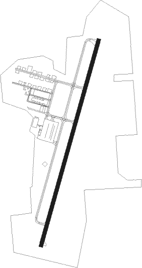
Runway info
| Runway 2 / 20 | ||
| length | 1251m (4104ft) | |
| bearing | 26° / 206° | |
| width | 23m (75ft) | |
| surface | asphalt | |
| displ threshold | 104m (341ft) / 56m (184ft) | |
Nearby beacons
| code | identifier | dist | bearing | frequency |
|---|---|---|---|---|
| VP | SEDLY (VALPARAISO) NDB | 15.3 | 193° | 212 |
| GIJ | GIPPER (NILES) VORTAC | 22.8 | 83° | 115.40 |
| GY | GARIE (GARY) NDB | 24 | 255° | 236 |
| OXI | KNOX VOR/DME | 24.1 | 156° | 115.60 |
| SB | MISHA (SOUTH BEND) NDB | 27 | 90° | 341 |
| CGT | CHICAGO HEIGHTS VORTAC | 35.6 | 256° | 114.20 |
| GSH | GOSHEN VORTAC | 37.1 | 103° | 113.70 |
| MX | KEDZI (CHICAGO) NDB | 38.9 | 273° | 248 |
| ELX | KEELER VOR/DME | 40.9 | 58° | 116.60 |
| EON | PEOTONE VORTAC | 50.8 | 246° | 113.20 |
| PMM | PULLMAN VOR/DME | 55.8 | 43° | 112.10 |
| UG | WAUKE (CHICAGO/WAUKEGAN) NDB | 63.2 | 308° | 379 |
Instrument approach procedures
| runway | airway (heading) | route (dist, bearing) |
|---|---|---|
| RW20 | EXCAP (206°) | EXCAP 2600ft |
| RNAV | EXCAP 2600ft LAPMY (6mi, 206°) 2300ft KMGC (5mi, 206°) 682ft (5263mi, 116°) 1055ft EXCAP (5259mi, 296°) 2600ft EXCAP (turn) |
Disclaimer
The information on this website is not for real aviation. Use this data with the X-Plane flight simulator only! Data taken with kind consent from X-Plane 12 source code and data files. Content is subject to change without notice.