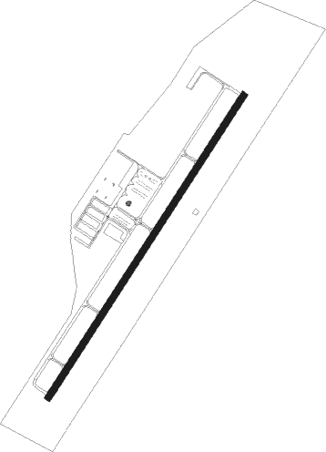
Louisburg - Triangle North Executive
Airport details
| Country | United States of America |
| State | North Carolina |
| Region | K7 |
| Airspace | Washington Ctr |
| Municipality | Franklin County |
| Elevation | 369ft (112m) |
| Timezone | GMT -5 |
| Coordinates | 36.02336, -78.33025 |
| Magnetic var | |
| Type | land |
| Available since | X-Plane v10.40 |
| ICAO code | KLHZ |
| IATA code | LFN |
| FAA code | LHZ |
Communication
| Triangle North Executive AWOS 3 | 118.325 |
| Triangle North Executive CTAF/UNICOM | 123.000 |
| Triangle North Executive RALEIGH Approach/Departure | 125.300 |
Approach frequencies
| ILS-cat-I | RW05 | 109.35 | 18.00mi |
| 3° GS | RW05 | 109.35 | 18.00mi |
Nearby Points of Interest:
Cascine
-Green Hill House
-Franklin County Training School-Riverside Union School
-Williamson House
-Louisburg Historic District
-Fuller House
-Person Place
-Andrews-Moore House
-Dr. J. H. Harris House
-Franklinton Depot
-Shemuel Kearney House
-Dr. Calvin Jones House
-Forestville Baptist Church
-Person-McGhee Farm
-Bennett Bunn Plantation
-George and Neva Barbee House
-Capehart House
-Dr. Samuel Perry House
-Midway Plantation House and Outbuildings
-Wendell Boulevard Historic District
-Wendell Commercial Historic District
-Sunnyside
-Oaky Grove
-Walnut Hill Cotton Gin
-Nash County Courthouse
Nearby beacons
| code | identifier | dist | bearing | frequency |
|---|---|---|---|---|
| LE | LEEVY (RALEIGH/DURHAM) NDB | 19.8 | 256° | 350 |
| HXO | HUNTSBORO (OXFORD) NDB | 21.7 | 314° | 271 |
| RDU | RALEIGH-DURHAM VORTAC | 23.8 | 252° | 117.20 |
| TYI | TAR RIVER (ROCKY MOUNT) VORTAC | 30.5 | 94° | 117.80 |
| JN | JURLY (SMITHFIELD) NDB | 33.2 | 190° | 263 |
| HUR | PERSON (ROXBORO) NDB | 37.8 | 286° | 220 |
| HQT | HARNETT (ERWIN) NDB | 39.2 | 210° | 417 |
| GSB | SEYMOUR JOHNSON TACAN | 44.8 | 152° | 116.50 |
| AQE | ALWOOD (GREENVILLE) NDB | 50.3 | 108° | 230 |
| SBV | SOUTH BOSTON VORTAC | 51.2 | 314° | 110.40 |
| LVL | LAWRENCEVILLE VORTAC | 52 | 28° | 112.90 |
| ISO | KINSTON VORTAC | 54.3 | 130° | 109.60 |
| IS | STALS (KINSTON) NDB | 56 | 141° | 276 |
| POB | POPE (FAYETTEVILLE) NDB | 56.7 | 218° | 338 |
| FGP | FORT BRAGG NDB | 58.1 | 209° | 393 |
| POB | POPE (FAYETTEVILLE) TACAN | 61.3 | 219° | 113.80 |
Instrument approach procedures
| runway | airway (heading) | route (dist, bearing) |
|---|---|---|
| RW05 | EKLAW (43°) | EKLAW 3400ft |
| RW05 | ROSOY (67°) | ROSOY 3400ft EKLAW (9mi, 104°) 3400ft |
| RW05 | YASKO (15°) | YASKO 3400ft EKLAW (9mi, 322°) 3400ft |
| RNAV | EKLAW 3400ft TANTE (9mi, 43°) 2400ft JEBIX (4mi, 43°) 1040ft KLHZ (2mi, 43°) 407ft (4840mi, 115°) 568ft JIPSI (4832mi, 295°) 2600ft JIPSI (turn) | |
| RW23 | JIPSI (223°) | JIPSI 2600ft |
| RW23 | KUDEC (194°) | KUDEC 2600ft JIPSI (9mi, 142°) 2600ft |
| RW23 | MIDVE (245°) | MIDVE 2600ft JIPSI (9mi, 276°) 2600ft |
| RNAV | JIPSI 2600ft JOPOT (9mi, 223°) 2100ft COGBO (4mi, 223°) 900ft KLHZ (2mi, 223°) 375ft (4840mi, 115°) 579ft ERUYO (4841mi, 295°) ZEBUL (4mi, 191°) 3300ft ZEBUL (turn) |
Disclaimer
The information on this website is not for real aviation. Use this data with the X-Plane flight simulator only! Data taken with kind consent from X-Plane 12 source code and data files. Content is subject to change without notice.