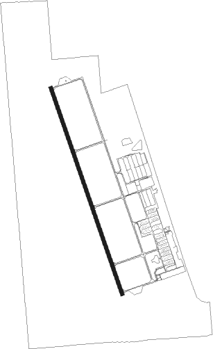
Lincoln - Lincoln Regl / Harder
Airport details
| Country | United States of America |
| State | California |
| Region | K2 |
| Airspace | Oakland Ctr |
| Municipality | Lincoln |
| Elevation | 121ft (37m) |
| Timezone | GMT -8 |
| Coordinates | 38.90375, -121.34511 |
| Magnetic var | |
| Type | land |
| Available since | X-Plane v10.40 |
| ICAO code | KLHM |
| IATA code | LHM |
| FAA code | LHM |
Communication
| Lincoln Regl / Harder AWOS 3 | 124.250 |
| Lincoln Regl / Harder CTAF/UNICOM | 123.000 |
| Lincoln Regl / Harder NORCAL Approach/Departure | 125.400 |
Approach frequencies
| ILS-cat-I | RW15 | 108.75 | 18.00mi |
| 3° GS | RW15 | 108.75 | 18.00mi |
Nearby beacons
| code | identifier | dist | bearing | frequency |
|---|---|---|---|---|
| MCC | MC CLELLAN (SACRAMENTO) VOR/DME | 14.4 | 194° | 109.20 |
| BAB | BEALE (MARYSVILLE) TACAN | 14.5 | 338° | 108.60 |
| MYV | MARYSVILLE VOR/DME | 15.8 | 311° | 110.80 |
| SAC | SACRAMENTO VORTAC | 29.2 | 204° | 115.20 |
| HNW | HANGTOWN (PLACERVILLE) VOR/DME | 29.8 | 107° | 115.50 |
| ILA | WILLIAMS VORTAC | 33.3 | 284° | 114.40 |
| SUU | TRAVIS (FAIRFIELD) TACAN | 48.5 | 222° | 116.60 |
| LIN | LINDEN VOR/DME | 52.3 | 158° | 114.80 |
| CCR | CONCORD VOR/DME | 61.1 | 219° | 117 |
Instrument approach procedures
| runway | airway (heading) | route (dist, bearing) |
|---|---|---|
| RW15 | RAILE (161°) | RAILE EJAAY (6mi, 161°) 2700ft |
| RW15 | YUBBA (117°) | YUBBA MYV (9mi, 97°) 2700ft EJAAY (7mi, 90°) 2700ft |
| RNAV | EJAAY 2700ft CODEY (6mi, 161°) 1800ft WIDBO (3mi, 161°) 680ft KLHM (3mi, 156°) 166ft (6839mi, 108°) 321ft MUCGU (6840mi, 288°) ROZZY (6mi, 139°) 2500ft ROZZY (turn) | |
| RW33 | FOLLY (314°) | FOLLY ROZZY (7mi, 293°) 2500ft |
| RW33 | GRIME (106°) | GRIME ROZZY (28mi, 119°) 2500ft ROZZY (turn) 2500ft |
| RNAV | ROZZY 2500ft MUCGU (6mi, 319°) 1600ft VESTT (3mi, 341°) 760ft KLHM (2mi, 349°) 151ft (6839mi, 108°) 480ft WILLD (6839mi, 288°) MYV (14mi, 307°) 2000ft MYV (turn) |
Disclaimer
The information on this website is not for real aviation. Use this data with the X-Plane flight simulator only! Data taken with kind consent from X-Plane 12 source code and data files. Content is subject to change without notice.
