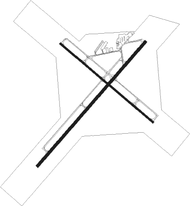
Laramie - Laramie Regl
Airport details
| Country | United States of America |
| State | Wyoming |
| Region | K1 |
| Airspace | Denver Ctr |
| Municipality | Laramie |
| Elevation | 7283ft (2220m) |
| Timezone | GMT -7 |
| Coordinates | 41.31205, -105.67500 |
| Magnetic var | |
| Type | land |
| Available since | X-Plane v10.40 |
| ICAO code | KLAR |
| IATA code | LAR |
| FAA code | LAR |
Communication
| Laramie Regl ASOS | 135.475 |
| Laramie Regl CTAF/UNICOM | 123.050 |
| Laramie Regl DENVER ApproachROACH | 125.900 |
| Laramie Regl DENVER DepartureARTURE | 125.900 |
Nearby Points of Interest:
Laramie Downtown Historic District
-St. Matthew's Cathedral (Laramie, Wyoming)
-Bath Row
-Old Main
-The Cooper Mansion, Laramie, Wyoming
-Union Pacific Athletic Club
-Sand Creek
-Oxford Horse Barn
-Bath Ranch
-Vee Bar Ranch Lodge
-Dale Creek Crossing
-DOE Bridge over Laramie River
-Woods Landing Dance Hall
-Centennial Work Center

Nearby beacons
| code | identifier | dist | bearing | frequency |
|---|---|---|---|---|
| LAR | LARAMIE VOR/DME | 2.5 | 299° | 117.60 |
| MBW | MEDICINE BOW VOR/DME | 35.2 | 328° | 116.85 |
| CYS | CHEYENNE VORTAC | 41.1 | 96° | 113.10 |
| FN | COLLN (FT COLLINS-LOVELAND) NDB | 65.3 | 143° | 400 |
| GYZ | CAMP GUERNSEY NDB | 70.4 | 46° | 280 |
Instrument approach procedures
| runway | airway (heading) | route (dist, bearing) |
|---|---|---|
| RW03 | LYMPS (105°) | LYMPS ZORIM (15mi, 148°) 11300ft ZORIM (turn) |
| RW03 | WALRU (66°) | WALRU ZORIM (24mi, 69°) 11300ft |
| RNAV | ZORIM 11300ft JOPUG (8mi, 67°) 8800ft WOKEX (3mi, 53°) 7800ft KLAR (2mi, 53°) 7328ft (6108mi, 111°) 7533ft FODIP (6105mi, 291°) POVOH (13mi, 72°) 11000ft POVOH (turn) | |
| RW12 | LAR (119°) | LAR GODKE (11mi, 309°) 10700ft GODKE (turn) 9800ft JIBIN (7mi, 126°) 8800ft |
| RW12 | LYMPS (105°) | LYMPS CUCAG (5mi, 74°) 11300ft GODKE (4mi, 74°) 9800ft JIBIN (7mi, 126°) 8800ft |
| RW12 | PUCIP (144°) | PUCIP GODKE (4mi, 253°) 9800ft GODKE (turn) 9800ft JIBIN (7mi, 126°) 8800ft |
| RNAV | JIBIN 8800ft DUTCE (3mi, 127°) 8400ft KLAR (4mi, 128°) 7316ft (6108mi, 111°) 7684ft FEKEP (6106mi, 291°) POVOH (16mi, 56°) 10700ft POVOH (turn) | |
| RW21 | CIKNA (207°) | CIKNA FIKEB (7mi, 158°) 10600ft |
| RW21 | POVOH (248°) | POVOH FIKEB (7mi, 289°) 10800ft FIKEB (turn) 10600ft |
| RNAV | FIKEB 10600ft ZEDOP (6mi, 219°) 9700ft HIMEG (6mi, 234°) 7820ft KLAR (2mi, 234°) 7325ft (6108mi, 111°) 7522ft YEKUS (6115mi, 291°) 9400ft YEKUS (turn) | |
| RW30 | FLEMS (306°) | FLEMS ICEDU (11mi, 305°) 10800ft KOGTE (4mi, 307°) 10300ft |
| RW30 | JESAR (274°) | JESAR ICEDU (10mi, 215°) 10800ft ICEDU (turn) 10800ft KOGTE (4mi, 307°) 10300ft |
| RW30 | LAR (119°) | LAR ICEDU (18mi, 125°) 11100ft ICEDU (turn) 10800ft KOGTE (4mi, 307°) 10300ft |
| RW30 | POVOH (248°) | POVOH ICEDU (19mi, 195°) 10800ft ICEDU (turn) 10800ft KOGTE (4mi, 307°) 10300ft |
| RNAV | KOGTE 10300ft ESIYO (3mi, 307°) 9900ft JANVA (6mi, 307°) 7980ft KLAR (3mi, 304°) 7316ft (6108mi, 111°) 7684ft LIRCI (6109mi, 291°) PUCIP (11mi, 326°) 9400ft PUCIP (turn) |
Disclaimer
The information on this website is not for real aviation. Use this data with the X-Plane flight simulator only! Data taken with kind consent from X-Plane 12 source code and data files. Content is subject to change without notice.