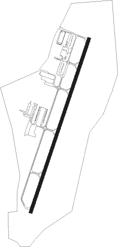
Smithfield - Johnston Co
Airport details
| Country | United States of America |
| State | North Carolina |
| Region | K7 |
| Airspace | Washington Ctr |
| Municipality | Johnston County |
| Elevation | 165ft (50m) |
| Timezone | GMT -5 |
| Coordinates | 35.54518, -78.39024 |
| Magnetic var | |
| Type | land |
| Available since | X-Plane v10.40 |
| ICAO code | KJNX |
| IATA code | n/a |
| FAA code | JNX |
Communication
| JOHNSTON CO AWOS | 120.225 |
| JOHNSTON CO CTAF/UNICOM | 122.800 |
| JOHNSTON CO RALEIGH Approach/Departure | 125.300 |
Approach frequencies
| ILS-cat-I | RW03 | 111.15 | 18.00mi |
| 3° GS | RW03 | 111.15 | 18.00mi |
Nearby Points of Interest:
Smithfield Masonic Lodge
-Johnston County Courthouse
-Hood Brothers Building
-Downtown Smithfield Historic District
-U.S. Post Office, Former
-Hood-Strickland House
-Four Oaks Commercial Historic District
-Clayton Banking Company Building
-Clayton Historic District
-Beaver Dam
-Walnut Hill Historic District
-Walnut Hill Cotton Gin
-Oaky Grove
-Sunnyside
-Wendell Commercial Historic District
-Wendell Boulevard Historic District
-Bentonville Battlefield
-Harper House
-Williams Grove School
-George and Neva Barbee House
-Midway Plantation House and Outbuildings
-Raleigh Water Works and E.B. Bain Water Treatment Plant
-Dunn Commercial Historic District
-East Raleigh-South Park Historic District
-Estey Hall
Nearby beacons
| code | identifier | dist | bearing | frequency |
|---|---|---|---|---|
| JN | JURLY (SMITHFIELD) NDB | 4.5 | 206° | 263 |
| HQT | HARNETT (ERWIN) NDB | 15.4 | 248° | 417 |
| GSB | SEYMOUR JOHNSON TACAN | 24 | 117° | 116.50 |
| RDU | RALEIGH-DURHAM VORTAC | 27.4 | 310° | 117.20 |
| LE | LEEVY (RALEIGH/DURHAM) NDB | 28 | 319° | 350 |
| FGP | FORT BRAGG NDB | 31.9 | 226° | 393 |
| POB | POPE (FAYETTEVILLE) NDB | 33.5 | 241° | 338 |
| CTZ | CLINTON NDB | 34.2 | 177° | 412 |
| POB | POPE (FAYETTEVILLE) TACAN | 38.2 | 239° | 113.80 |
| IS | STALS (KINSTON) NDB | 38.4 | 114° | 276 |
| FAY | FAYETTEVILLE VOR/DME | 41.1 | 221° | 108.80 |
| ISO | KINSTON VORTAC | 42 | 102° | 109.60 |
| TYI | TAR RIVER (ROCKY MOUNT) VORTAC | 42.3 | 58° | 117.80 |
| HXO | HUNTSBORO (OXFORD) NDB | 46.7 | 343° | 271 |
| HUR | PERSON (ROXBORO) NDB | 52.8 | 316° | 220 |
| OA | ELLAS (JACKSONVILLE) NDB | 58.4 | 139° | 261 |
| NCA | NEW RIVER TACAN | 68.6 | 131° | 115.40 |
| JB | JIGEL (LUMBERTON) NDB | 70.3 | 217° | 384 |
| DIW | DIXON NDB | 74.5 | 136° | 198 |
Instrument approach procedures
| runway | airway (heading) | route (dist, bearing) |
|---|---|---|
| RW03 | WITIX (27°) | WITIX 3000ft |
| RNAV | WITIX 3000ft JIHDI (7mi, 28°) 1500ft KJNX (5mi, 27°) 192ft (4839mi, 114°) 397ft JNALL (4838mi, 294°) 3400ft JNALL (turn) | |
| RW21 | HUNUL (209°) | HUNUL 3300ft |
| RNAV | HUNUL 3300ft JNALL (7mi, 208°) 1500ft CUMUT (2mi, 208°) 780ft KJNX (2mi, 211°) 213ft (4839mi, 114°) 518ft JIHDI (4840mi, 294°) 2700ft JIHDI (turn) |
Disclaimer
The information on this website is not for real aviation. Use this data with the X-Plane flight simulator only! Data taken with kind consent from X-Plane 12 source code and data files. Content is subject to change without notice.